Day 12 – Sunday – August 12, 2018
Trans-Labrador Highway to Goose Bay
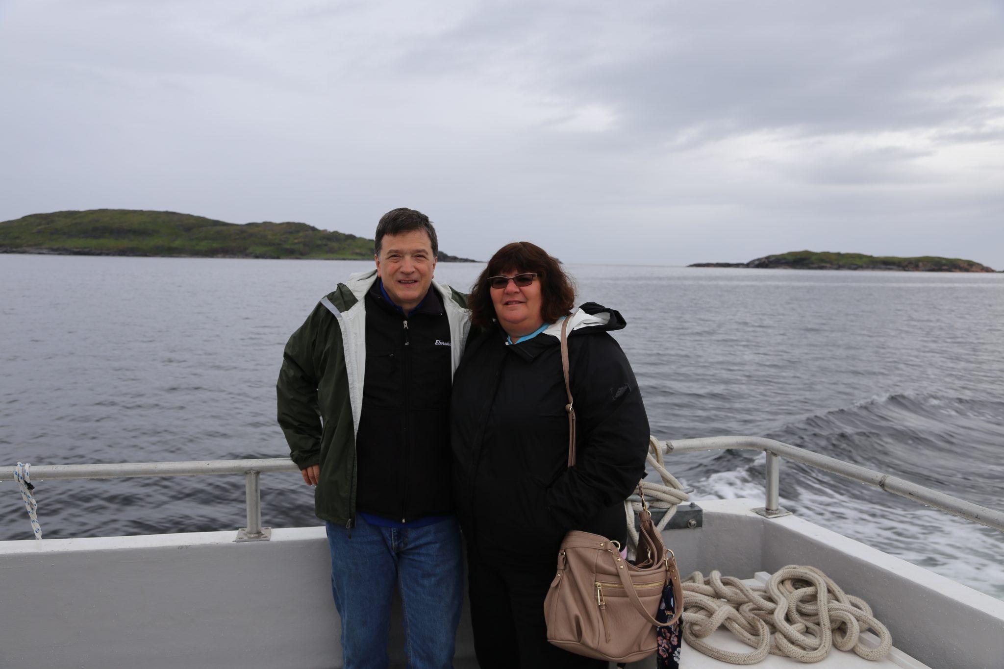
We left Battle Harbour after a thoroughly enjoyable stay there. We headed back on Trinity Pride to Mary’s Harbour. The weather was overcast but the seas were smooth. The 13 mile trip was an opportunity to say our goodbyes to our fellow guests and dinner companions.
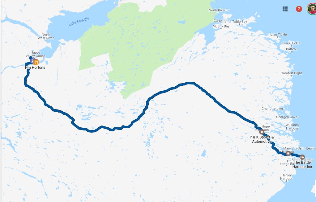
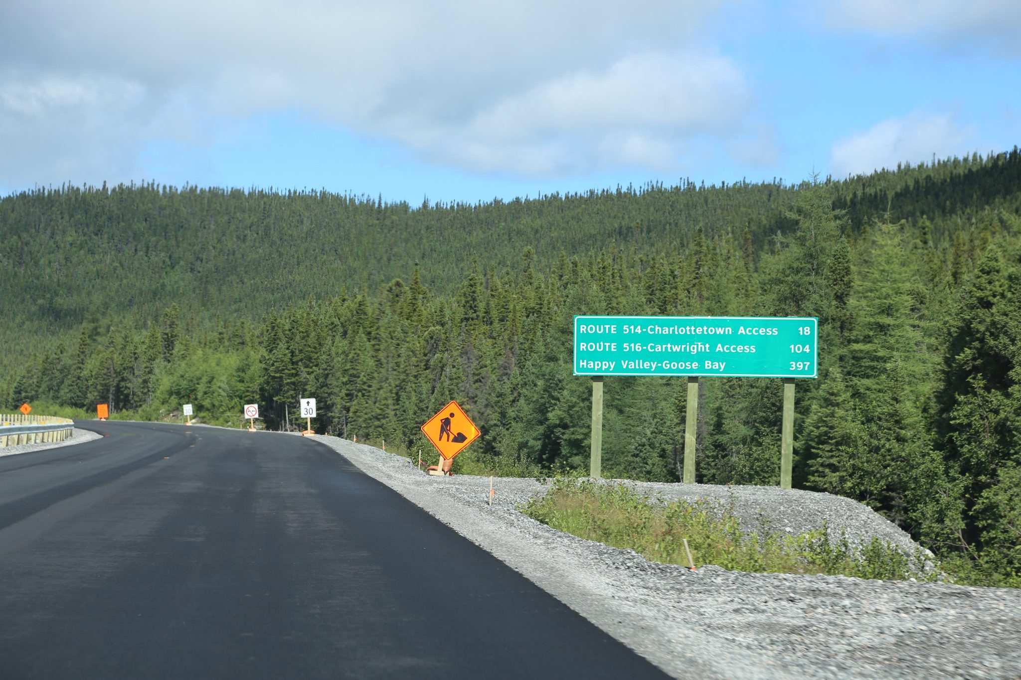
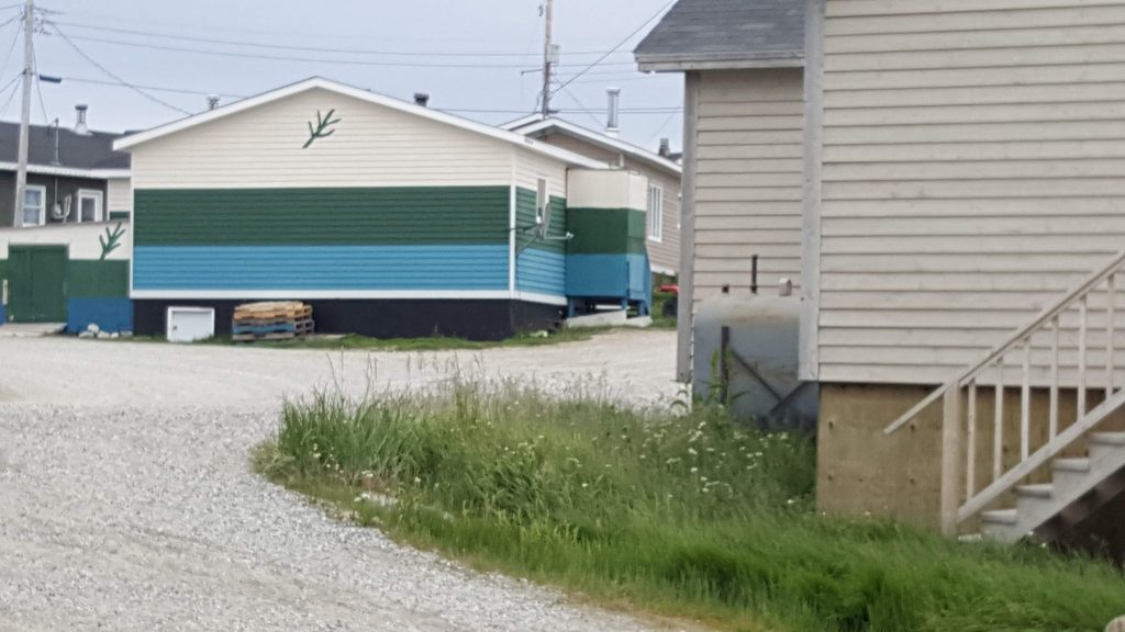
We headed north toward Happy Valley-Goose Bay. This part of the journey was going to get more interesting. It is 280 miles and a good part of it is gravel road so this can take 6 1/2 hours. The Trans-Labrador Highway south of Goose Bay is dubbed the Labrador Coastal Drive but rapidly heads away from the coast and goes deeply inland eventually skirting around Mealy Mountain Reserve until taking you to Goose Bay.
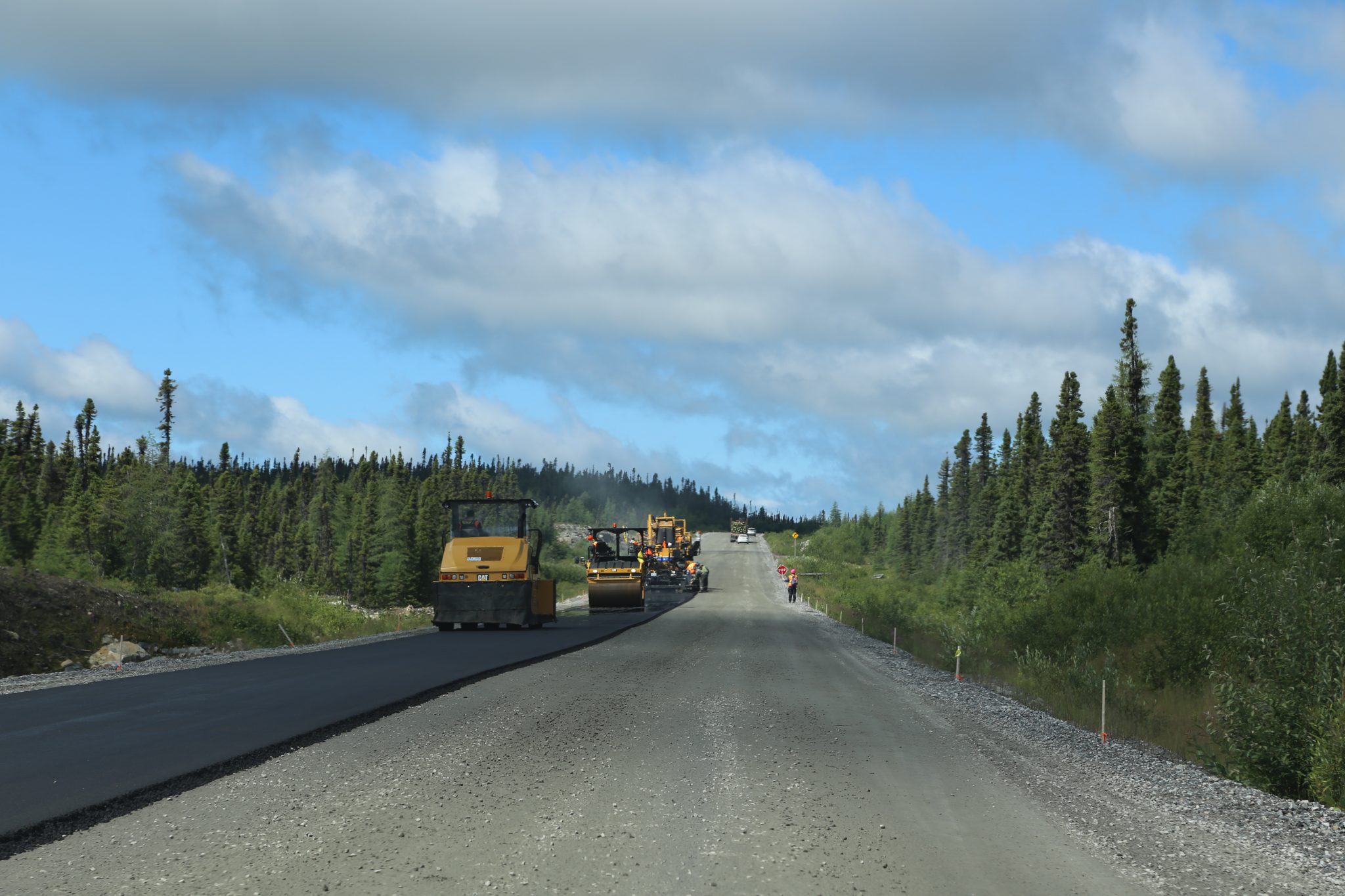
You go onto a gravel road quickly as you head north from Mary’s Harbour. There is a short reprieve on the new paved section in Port Hope Simpson but after that it is about 200 miles of gravel until 50 miles from Goose Bay. The section of road south of Goose Bay wasn’t completed until 2009 and before that many of these communities along the coast had no road access to the outside world. The gravel was a huge improvement for them over no road at all. There is paving going on to finally have the road paved from end to end. We got stopped in several areas for paving activity and it occurred to me that I could never recall ever seeing a key through road being paved for the first time. Maybe some of the last interstates in the 1960s when I was very young? The logistics of paving are complicated as you have to actually build an asphalt plant, mine the crushed stone near the road, and maintain the equipment. There just isn’t that kind of infrastructure in Labrador. I saw this article about the process you might find it interesting.
https://www.rocktoroad.com/news/labrador-ride-4212
We were definitely not on the beaten track!
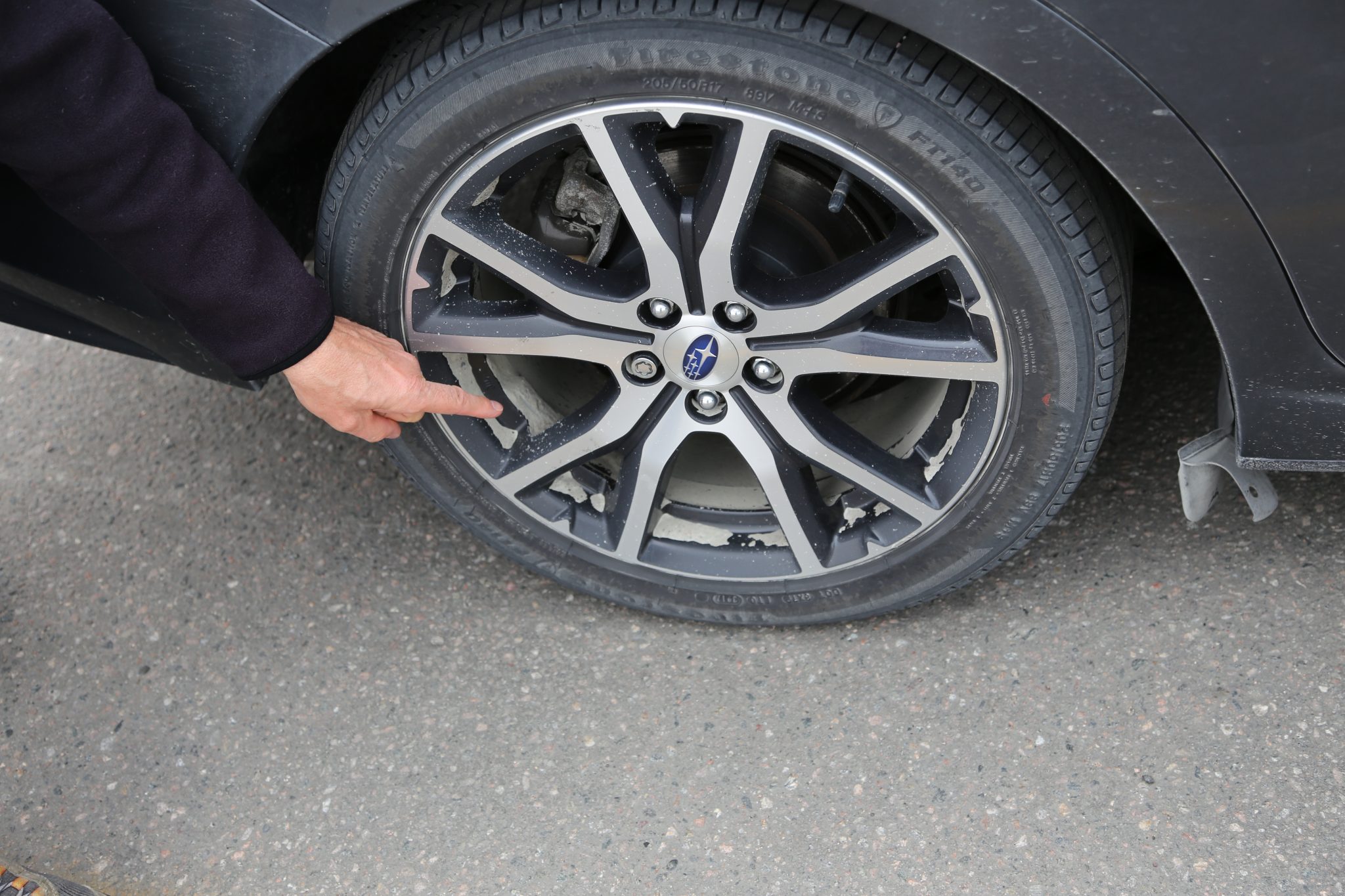
We headed along the gravel and surface was generally good although potholed in some areas. Still you had to be careful, the curves could be loose and even in a 4WD Subaru they could feel unstable at times. We passed a vehicle going the opposite direction and took a hard hit from a stone on the passenger side that caused damage to the windshield that looked like an ant splatted there. We learned to be sure to get as far to the right as possible when we saw an on coming vehicle.
It really wasn’t too much of a problem as there were not many vehicles we passed going the other direction and just a few who passed us or that we passed. There is just not a lot of traffic on this road. You may not see cars but you do see pristine lakes and forest spreading out before you. It is beautiful and remote and not a place you want to break down. We had a full size spare tire with us because you wouldn’t want to travel this road on a doughnut spare or worse, a run flat tire. I realized after a time that I had forgotten to pickup one of the loaner satellite phones in Port Hope Simpson but that was well behind us.
We half expected to be dodging caribou and moose in Labrador but so far there had been none. We had talked to people in Battle Harbour and learned that the caribou herds apparently had not been seen lately and nobody was sure what had happened to them. We saw no wildlife on this stretch of road!
After the long drive on gravel we were glad to get back onto pavement and that meant we were close to Goose Bay and coffee. We found a Tim Horton’s and saw how the car was covered in dust and quite a bit accumulated in the wheels. I also saw the plastic pin holding on the mini mud flaps in front of the rear wheels had sheared off and they were kind of hanging off. The gravel road was rough on the car.
We went in for some coffee I noticed a couple things. First, there was a man waiting for a order and he was black. I realized at that moment that I couldn’t think of the last time I had seen a black person – St Johns? Nova Scotia? Maine? Apparently the demographics of much of far eastern Canada are very white / European. This guy didn’t appear to be local as he wore a uniform that indicated he was working on the Muskrat Falls hydro project. The other demographic thing I noticed was an number of people who apparently from the First People for this area, the Innu or Inuit. We didn’t really see many of the First People in southern Labrador. We certainly would see many more as we would be soon heading up the coast of Nunatsiavut, a semi-autonomous region of Labrador and the home of the Labrador Inuit.
We headed to our lodging for the night, the Big Land Bed and Breakfast. This was sort of like an Airbnb in that it was located in a neighborhood and the owner had a section of the house with a couple of bedrooms partitioned off for guests. He was a hospitable host and our small room was clean and comfortable. We spent the evening repack for the next leg of our journey by boat. I also dealt with the frustrating Labrador Internet as I struggled to upload pictures to the blog.
Today we drove 298 bumpy and gravely miles over 7 hours and 18 minutes for a trip total of 2388 miles. We added one more boat ride of 13 miles for a total of six trips. The water total is now at 425 miles and 20 & 1/2 hours.
Day 13 – Monday – August 13, 2019
Goose Bay and out to Sea
We started our day with a nice breakfast at the B&B and there we met a woman from Rigolet who was staying for a couple of days with her young son. She was on her way to Disney World and it was cheaper for her to take the ferry on its schedule and stay a few days in Goose Bay rather than flying from Rigolet. Rigolet is west from Goose Bay and is accessed by air or as the first stop on the ferry northward. It is about 100 miles west yet is isolated due to no road access. We talked about her experiences with teaching in Labrador and a small isolated community like Rigolet. She mentioned how her son had marveled at the paved road in Goose Bay as it was the first time he had seen them. We bid our farewell’s and our host even gave us a jar of homemade bakeapple jam.
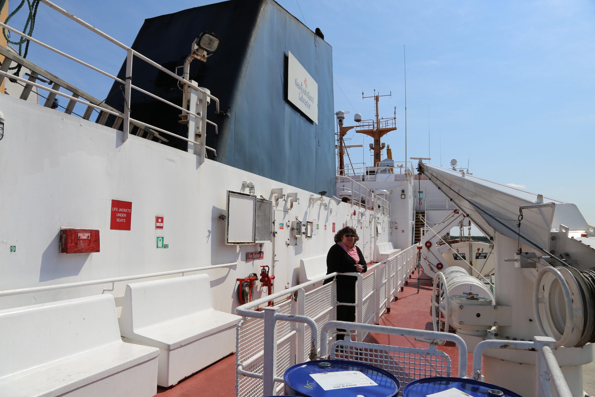
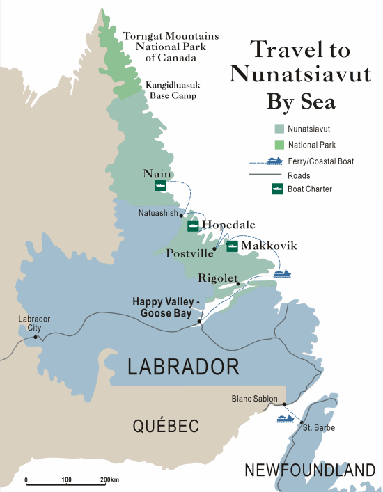
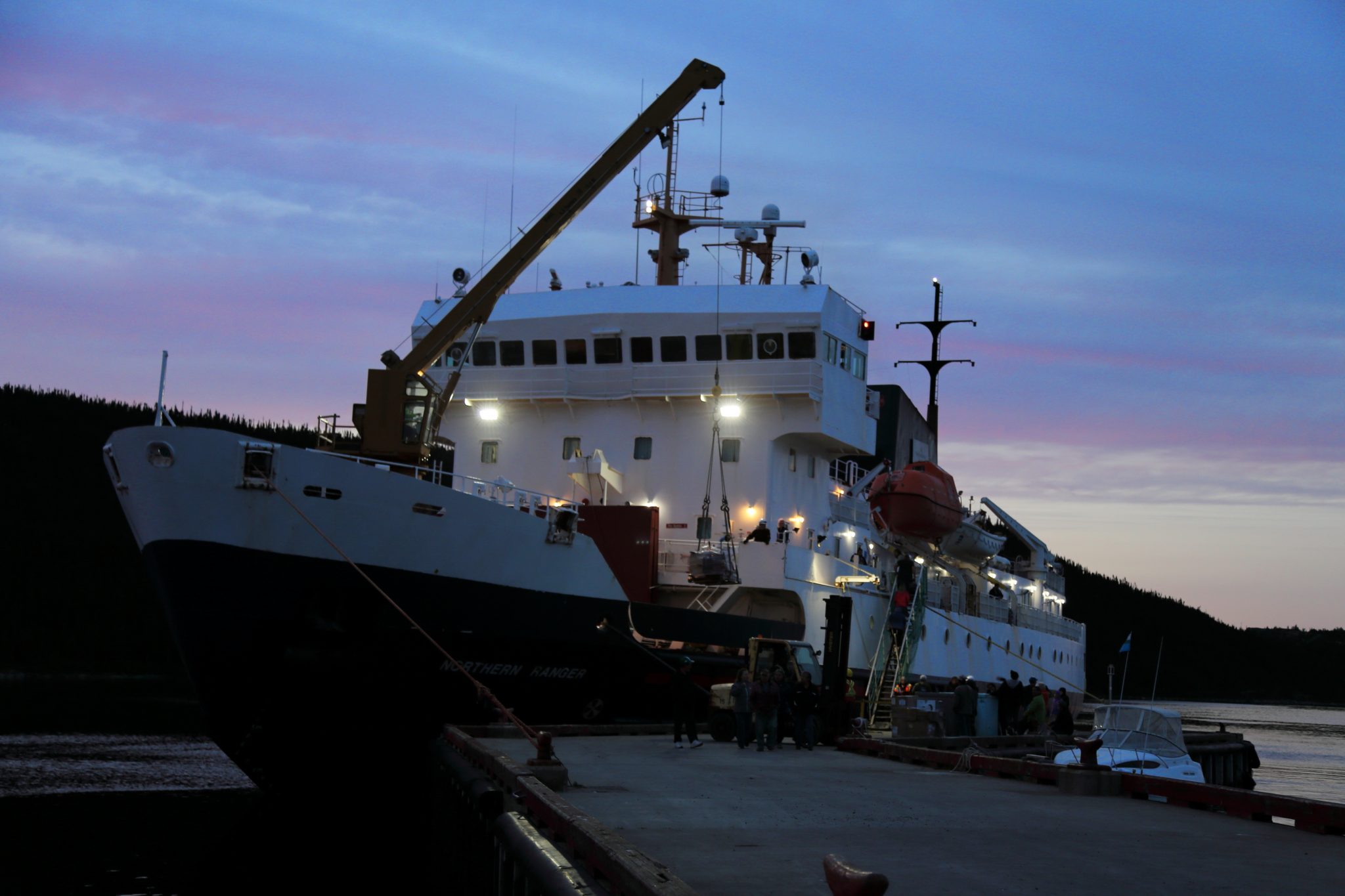
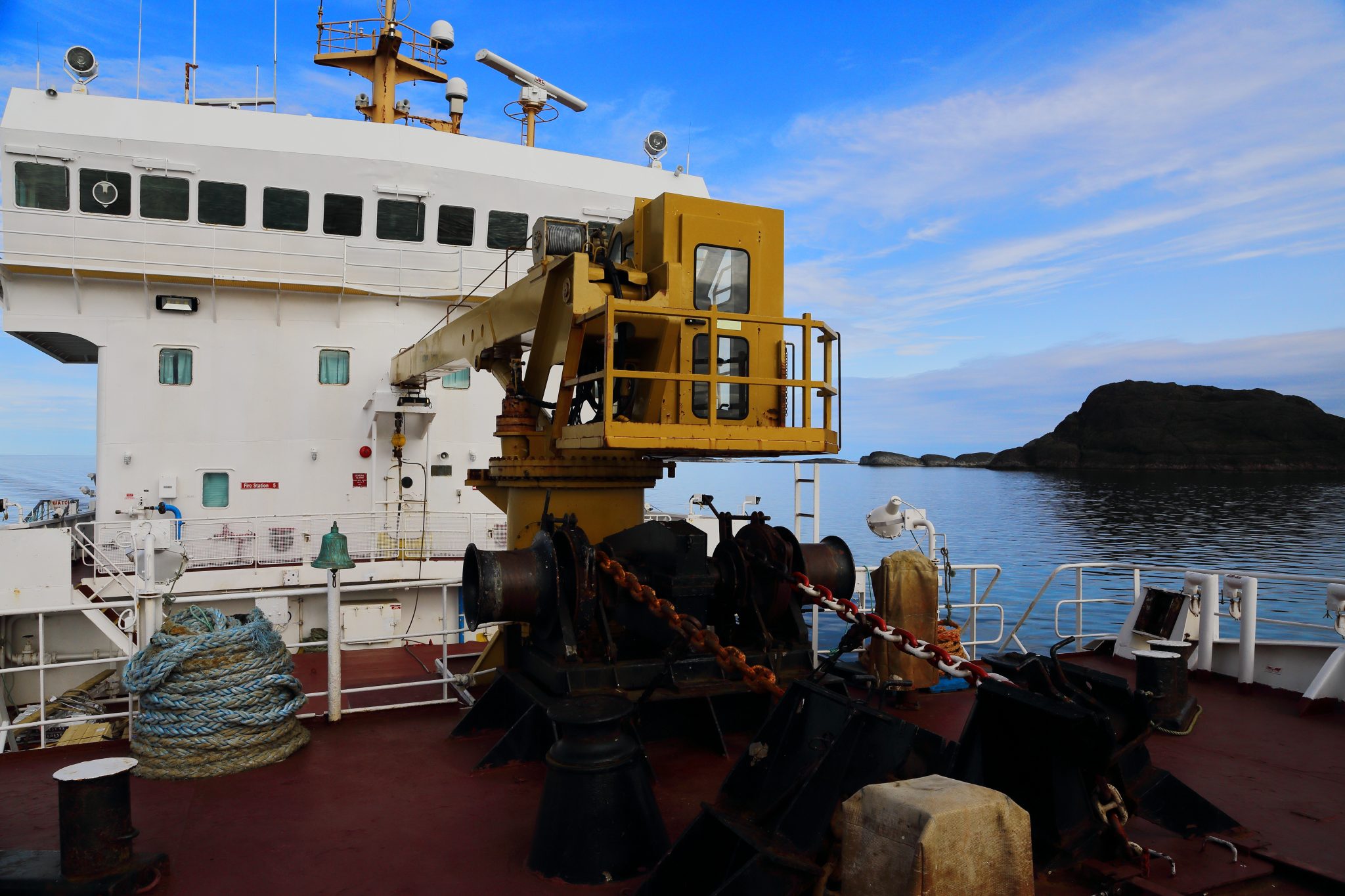
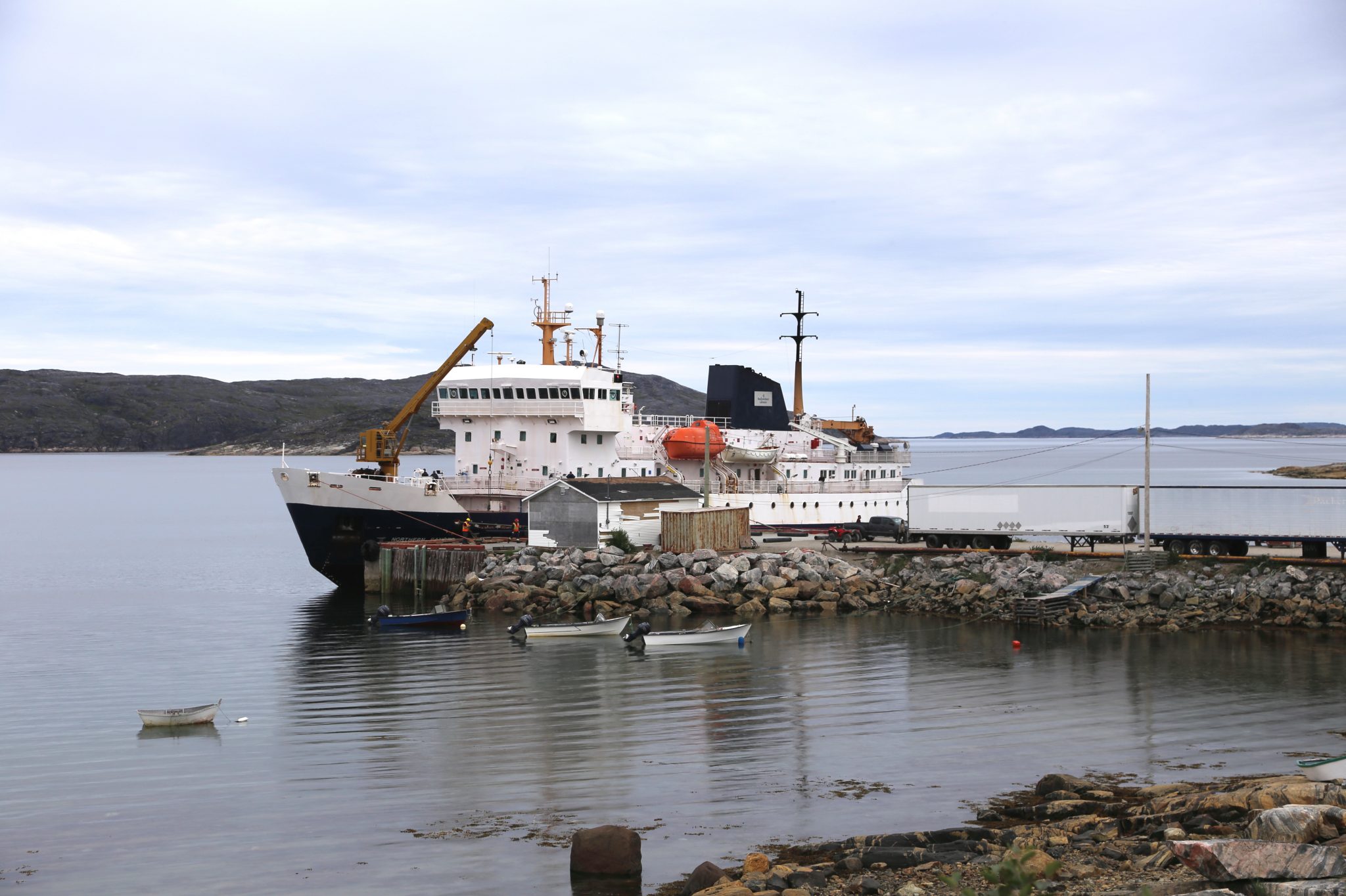
Went to the Nunatsiavut Marine office to get our ticket for the trip on the MV Northern Ranger. They still prepare them by hand. The Northern Ranger is 235 foot long an ice-breaking coastal ferry that runs from mid-June until sometime in December. It is a working ship with a crew of 21 providing a vital seasonal link to the small communities of Nunatsiavut which are along the northern coast of Labrador. It carries smaller cargo and passengers during these warmer months. The Astron carries the larger cargo. When the ship isn’t running you go to these places by air or snowmobile trails. Nain is the furthest north and going there would be a trip of 100’s of miles by snowmobile. We of course had a more comfortable method although I had jokingly told Debbie we were going on a “tramp steamer”. It’s not that but is certainly not a luxury cruise.
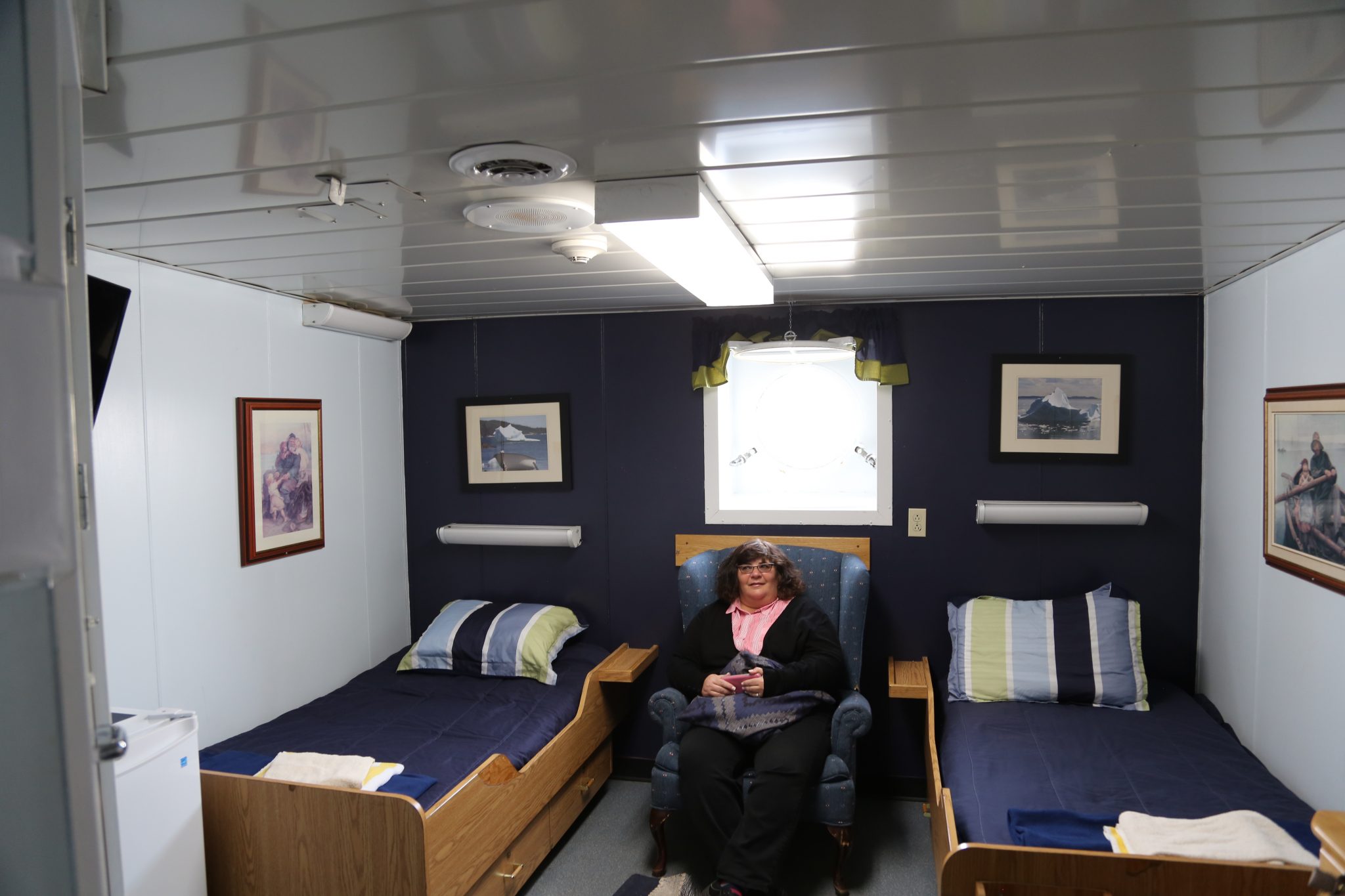
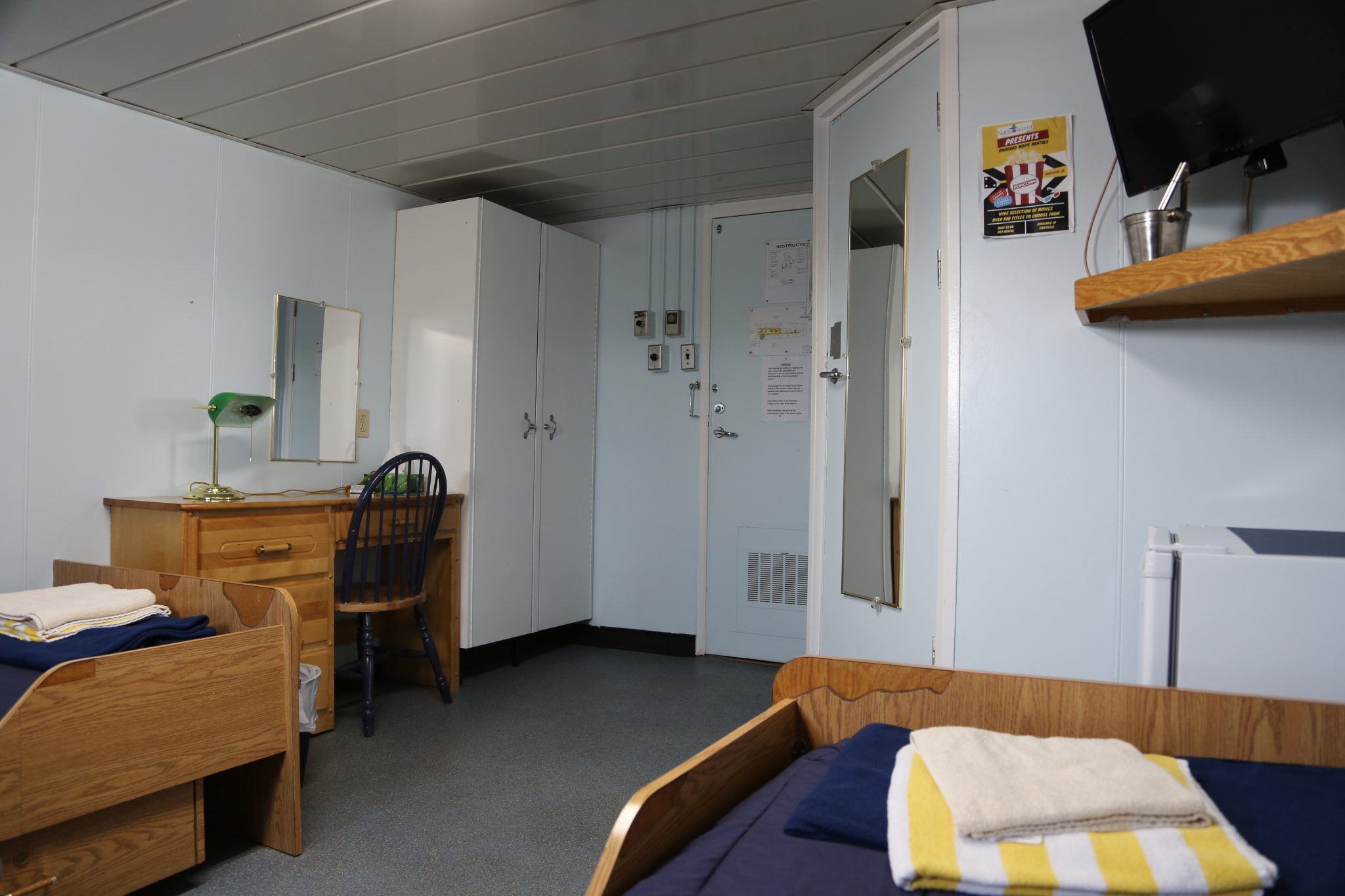
We got aboard early and settled into our cabin. I booked the deluxe cabin which has 2 twin beds, a desk, lounge chair, TV, and fridge. It is reasonably roomy and not at all claustrophobic. Deluxe is all relative and while it was not luxury it certainly served us well on this trip. I would often use the desk to type notes and Debbie tended to be in the lounge chair reading. It was a comfortable place to sleep and relax when we didn’t want to be somewhere else.
We departed Goose Bay at 1:00PM and we were excited about our upcoming journey and also looking forward to relaxing on it. We went up on deck as the ship departed and quickly met one of our fellow travelers. Nelson is a semi-retired marine pilot from Placentia, Newfoundland making his first trip on the Northern Ranger. He was going to Nain to guide in a large vessel to the port there. He was very friendly and outgoing and as the Ranger headed out he talked about some of the issues of navigating the channels. He really was kind of a character but in a good way! They announced the opening of the cafeteria, and since you only have a short time, we headed right down. You don’t take this trip for the fine dining. We knew this in advance and our first time into the cafeteria for some lunch confirmed this was true. It’s the kind of cafeteria with a line where you picked from pre-made sandwiches or a hot item lodged firmly in the comfort food category. Space and staff are limited on the Northern Ranger, so choices are limited. Sandwiches were what we picked as it was more appealing than the hot choice.
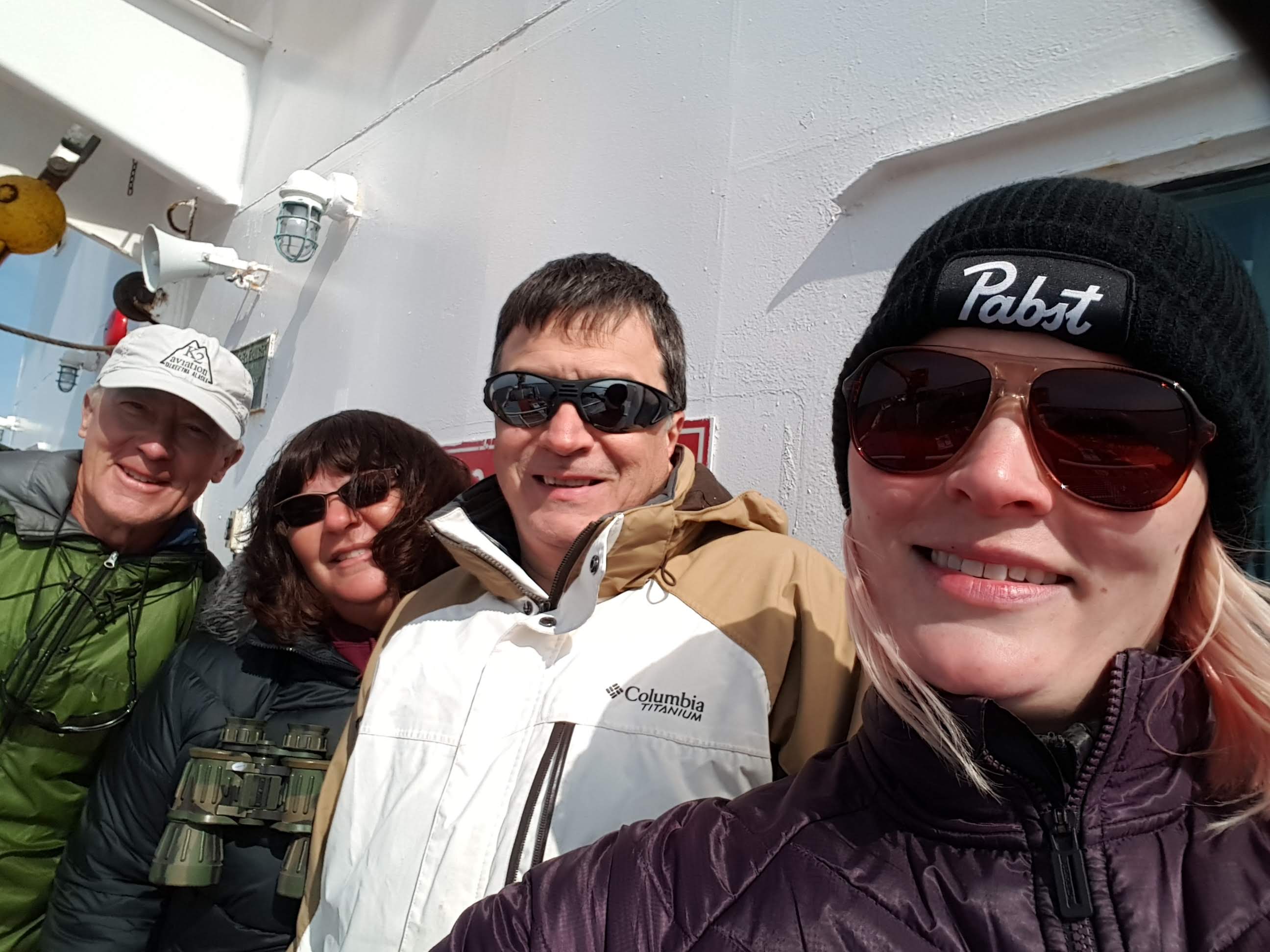
We were heading generally eastward out into Lake Melville to our first port of call in Rigolet. We met some of our fellow tourist travelers as we explored the decks for the ship. Michele and his 16-year-old grandson who live near Montreal. Dave, a retired highway engineer from Arlington, Virginia who is making the journey to Nain by water in one direction and by air for the return. We also met Anne, a young woman from Idaho who quit her job in a basement office and went off on a summer adventure. She had originally hoped to do a similar trip in Norway, the land of her ancestors, but getting a cabin by herself was cost prohibitive. The Northern Ranger has some shared rooms like a hostel and she could book one at a more reasonable cost so this became her journey instead. You could see the Nordic ancestry in her as she was quite tall and a blonde. There were few retired couples making the round trip although we didn’t speak to them as much since they didn’t go where we tended to congregate.
Rigolet
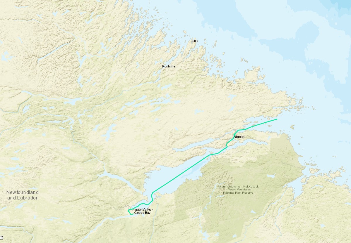
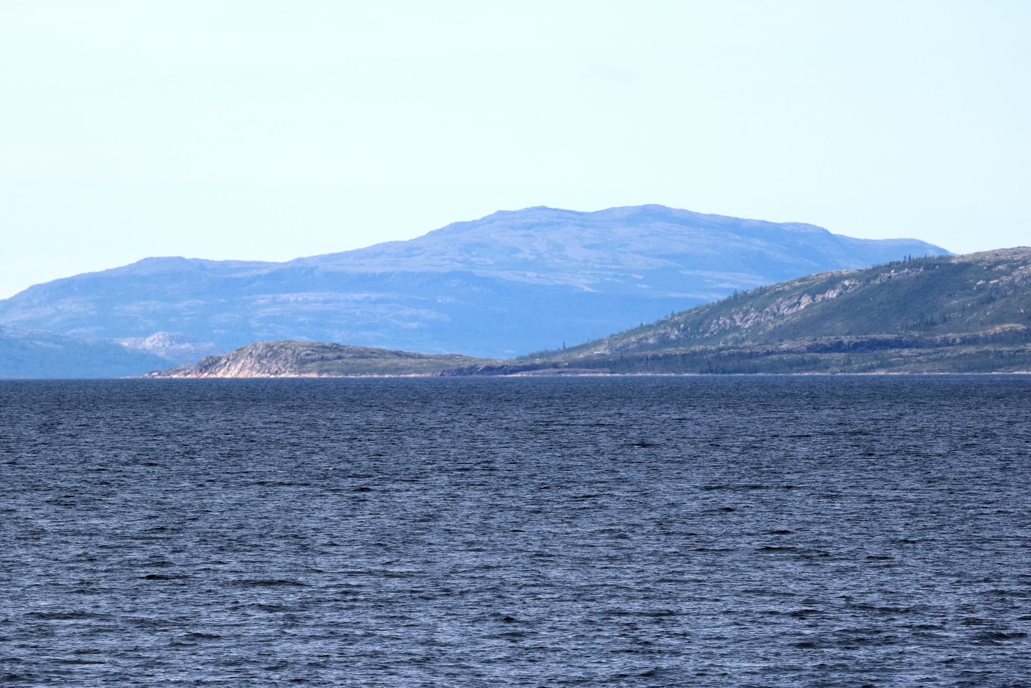
It was cloudy as we went westward across Lake Melville toward the Labrador Sea. We would see the Mealy Mountains Nation Park Reserve off our right to the south as we got closer to Rigolet. We wound through channels between islands until at about 8:00 in the evening we arrived into Rigolet (pop. 310) having traveled 110 miles over 7 hours.’
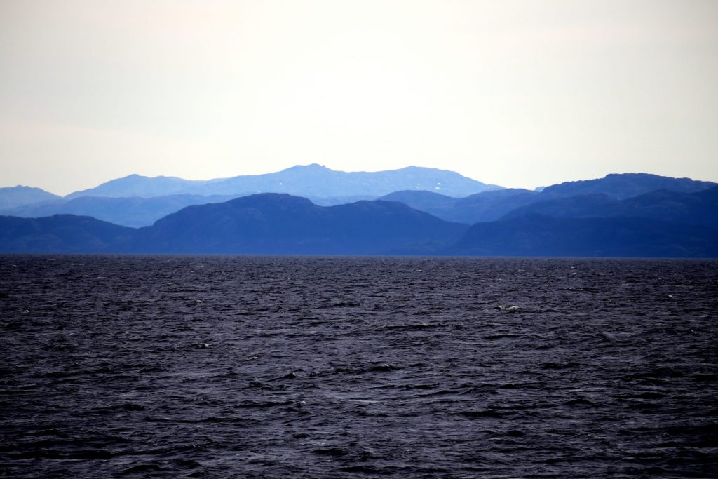
Mealy Mountains
from Lake Melville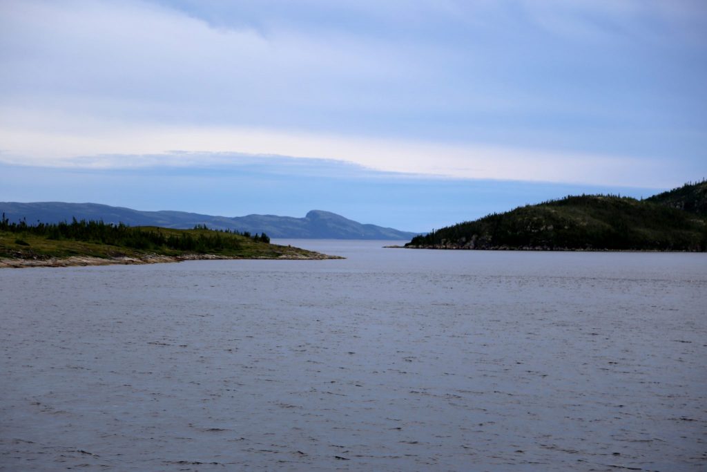
Through the channels
to Rigolet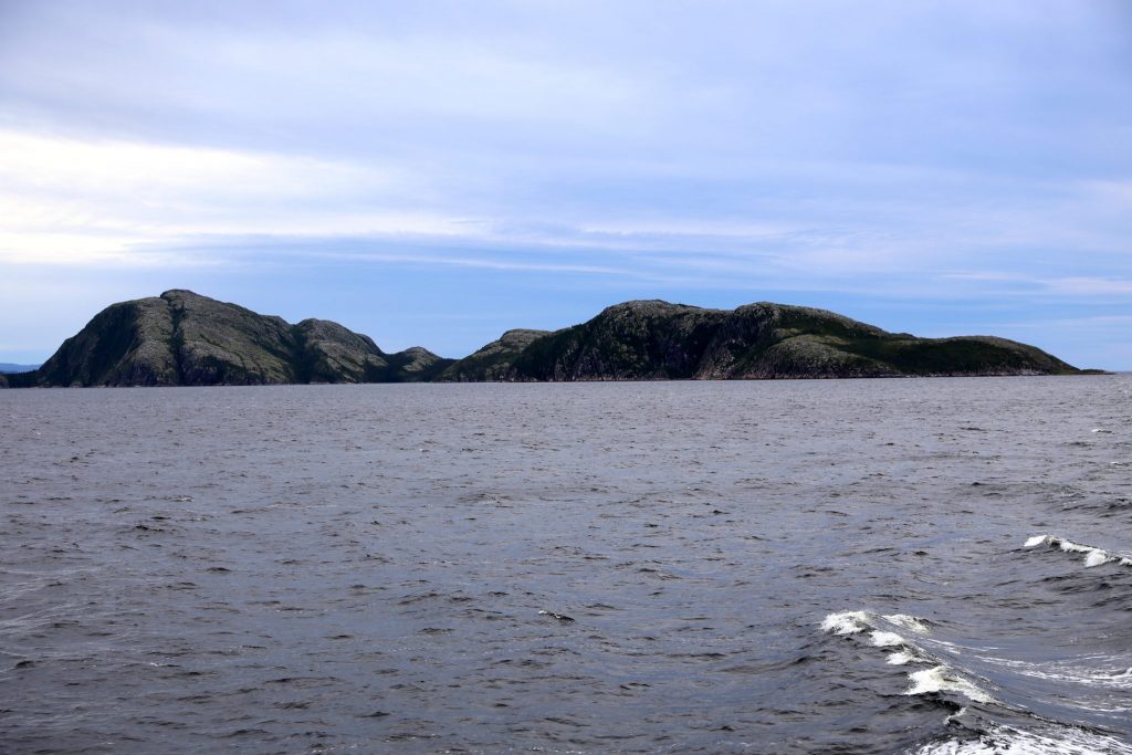
Rocky Islands in Lake Melville
We headed off the ship but Debbie was not too happy about the wobbling clanking gangway down to the pier. The stair treads folded up when it was raised and lowered so it felt much too unstable for her liking. I reminded her that we had to leave the ship at some point, so she might just as well get used to it at the first port of call. She was unconvinced of its safety and was not impressed as I bounded down to show her how strong it was!
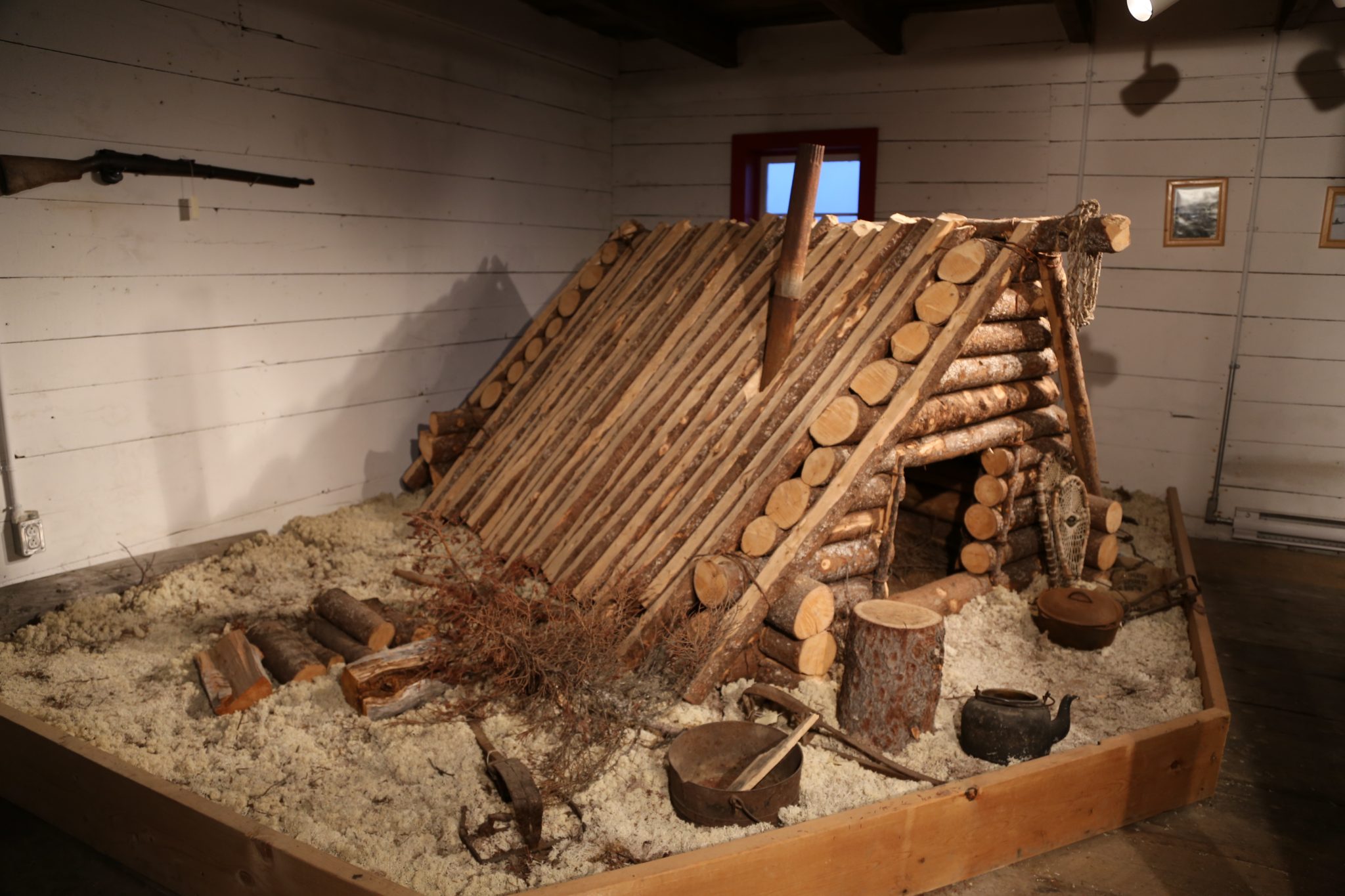
We headed over to the Net Loft Museum which is originally a building from 1876 used by the Hudson Bay Company. The upper area of it had 32 storage bunks each assigned to a different area fishing station and held nets and other gear. We saw a replica of a trapping shelter used in the past. Our visit was short and naturally we visited the adjoining adjoining craft store on our way out.
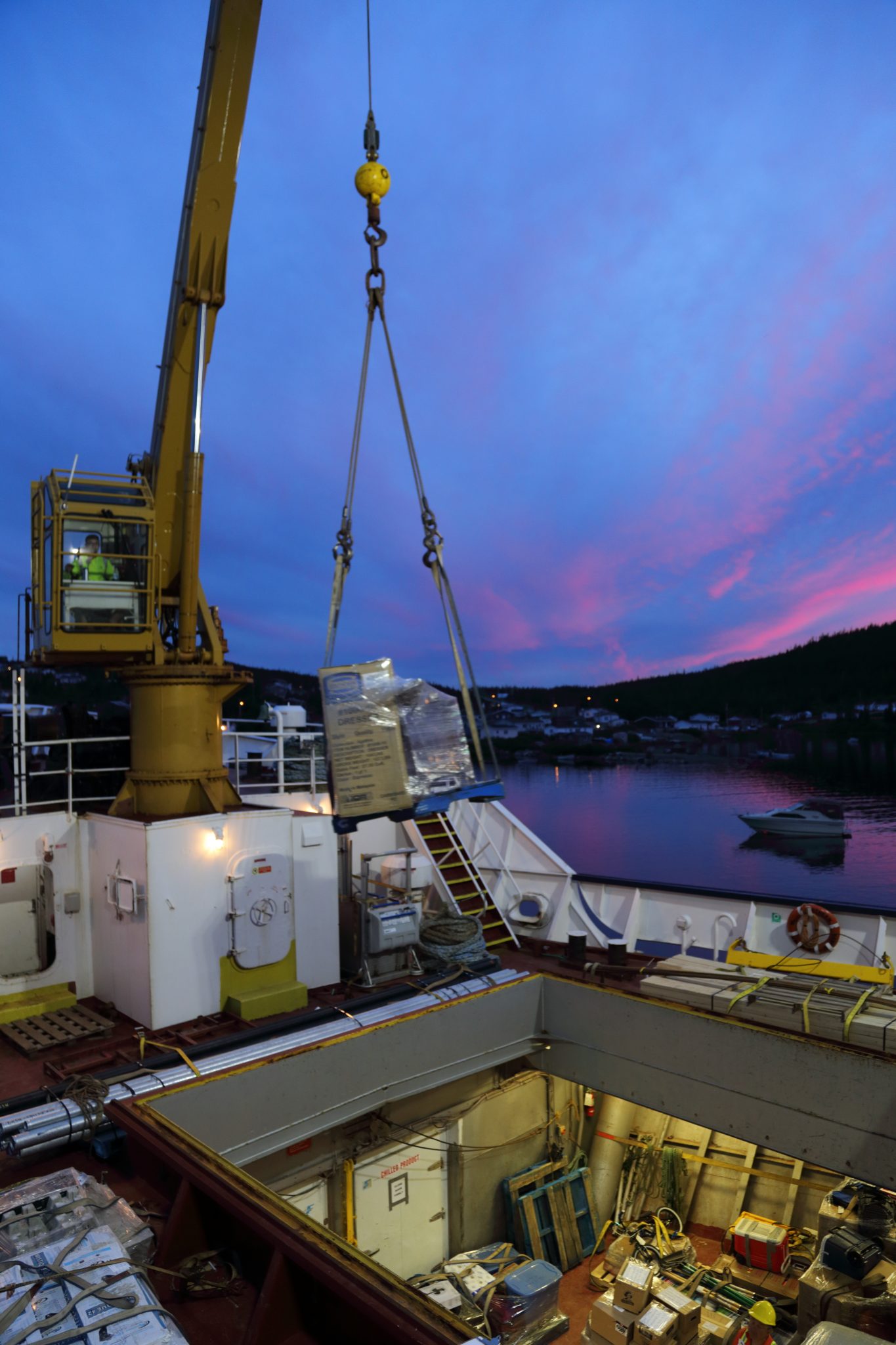
We returned to ship and decided to watch the loading and unloading of the cargo hold at the front of the ship. There we really got to see the legendary Labrador bugs but fortunately our mesh jackets impregnated with InsectShield (permethrin based) really helped keep them at bay. Watching cargo activity at each port became a regular spectator sport for us and the other tourist passengers. An amazing a variety of small and large items were quickly moved by crane on and off the ship. Some went down into the hold and others got strapped down onto the desk around the large forward hatch. We saw snowmobiles, small boats, pieces of houses, household goods, outboard motors, and just about anything else you could think that someone might use. They do this in as little as 1 ½ hours from arrival to departure.
Leaving Rigolet at 9:00PM we headed west out of Lake Melville for a few hours eventually turning northwest as we entered the Labrador Sea. We eventually headed to bed and slept as we sailed overnight along the rugged coast toward Makkovik. In the morning getting to the boat only added only 5 miles of driving for a total of 2393 miles. The Northern Ranger is our seventh trip by sea and with the initial 110 miles to Rigolet its now 535 miles on the water.
Day 14 – Tuesday – August 14, 2018
Overnight at sea, Makkovik, Postville, Hopedale, and Natuashish overnight
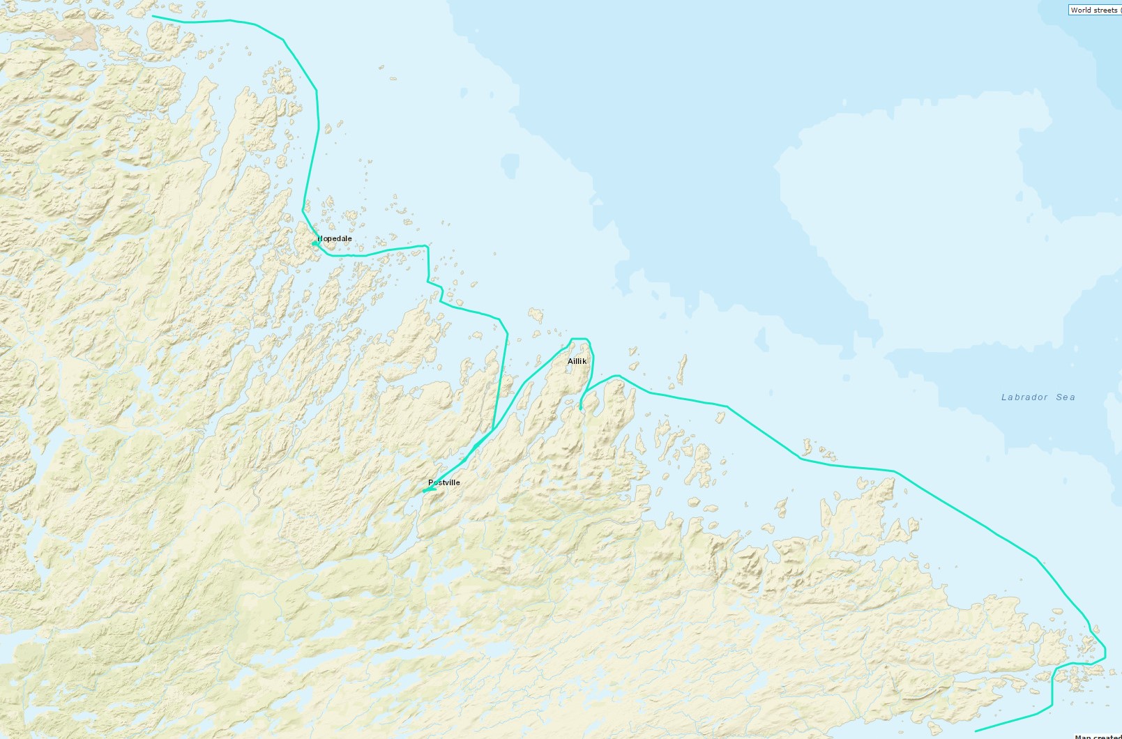
North Along the Labrador Coast
The rhythm of the ship revolves around the ports of call and of course meals. There are specific times for them and it’s usually no more than an hour. If you don’t get up early you will miss your breakfast, so we dragged ourselves out of bed at 7:00AM to get some just prior to our 7:30 arrival into Makkovik (pop. 361). We had traveled sea 163 miles from Rigolet and it took 10 hours and 30 minutes. We weren’t terribly ready to go out anywhere so just watched the loading activity and didn’t disembark. We departed at 9:00 AM continuing northwest up the coast.

Makkovik Docks 
Many different things loaded
On the sides of the ship there are benches and you can look out at the water from there or stand just forward of the area below the bridge which overlooks the forward cargo area. We had soon figured out we could head down stairs near there, pick our way across the cargo, and head up the forward stairs to the bow. Traveling on the Northern Ranger you are more intimate with the water than on a large ship. You can peer over the bow and the waters is perhaps 20 or 30 feet below you. It was a little extra effort to go there so there was rarely more than a few people there. On the northward leg, besides us, it was mostly Dave, Anne, and sometimes Nelson. Anne dubbed us all the “bow riders”.
Notice the warm clothes
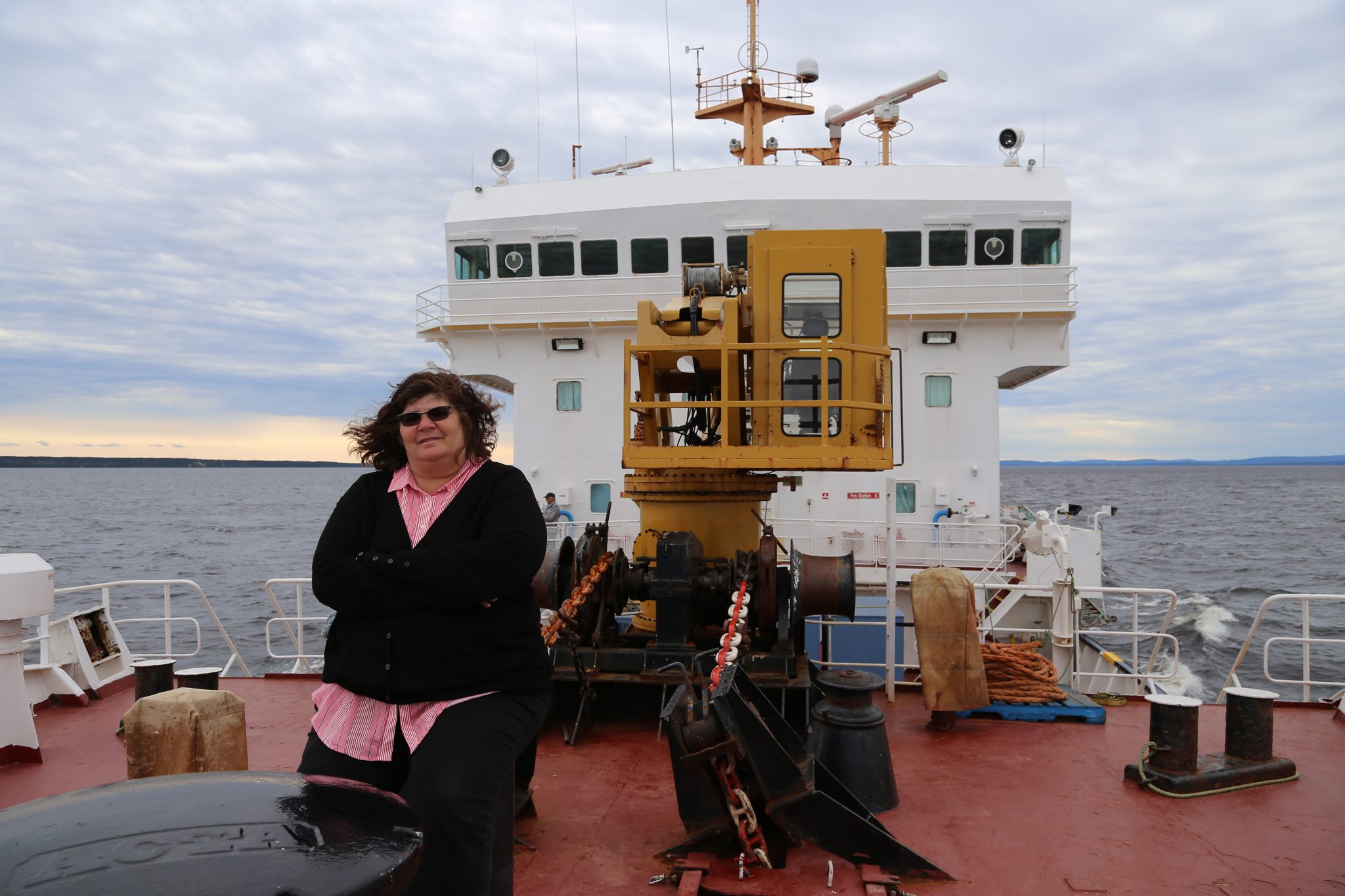
The bow was really the best place to be. There were no benches like on the sides, but you could hang over the bow or improvise a seat on this sort of post behind the big round capstan sitting dead center right up front. Debbie spent a lot of time sitting there which you can see in the picture earlier in the post. You get nearly 360-degree views and the breeze was much gentler than in front of the bridge area. We spend a lot of time there over the next several days watching the coast and islands slide by us as we looked for icebergs, sunsets, seabirds, and marine life.
Postville (pop. 180) is situated at the well into a long narrow inlet. Coming from Makkovik the ship heads northeast toward the Labrador Sea and does a slow 180 degree around a large point of land to turn southwest toward Postville. Once you make that turn you have about 10 miles before you enter the arm of the sea known as Kiapokok Bay. You travel another 20 miles down this narrow fjord like area surrounded by rugged cliffs with scrub trees struggling to grow in the harsh climate.
As we worked our way around the land toward the bay we were furthest out in the Labrador Sea. When you travel the coast here, you are in the cold Labrador current which flows southward. This usually means icebergs are visible during the late spring into summer. Mid-August is late in the iceberg season but keeping a sharp eye to the sea was rewarded when Nelson spotted a couple of them in the distance. You could see them gleaming in the sun and they seemed large, but it was difficult to say without something to compare them with. Fortunately, we were prepared with binoculars and zoom lens. They were starkly beautiful shimming in the distance.
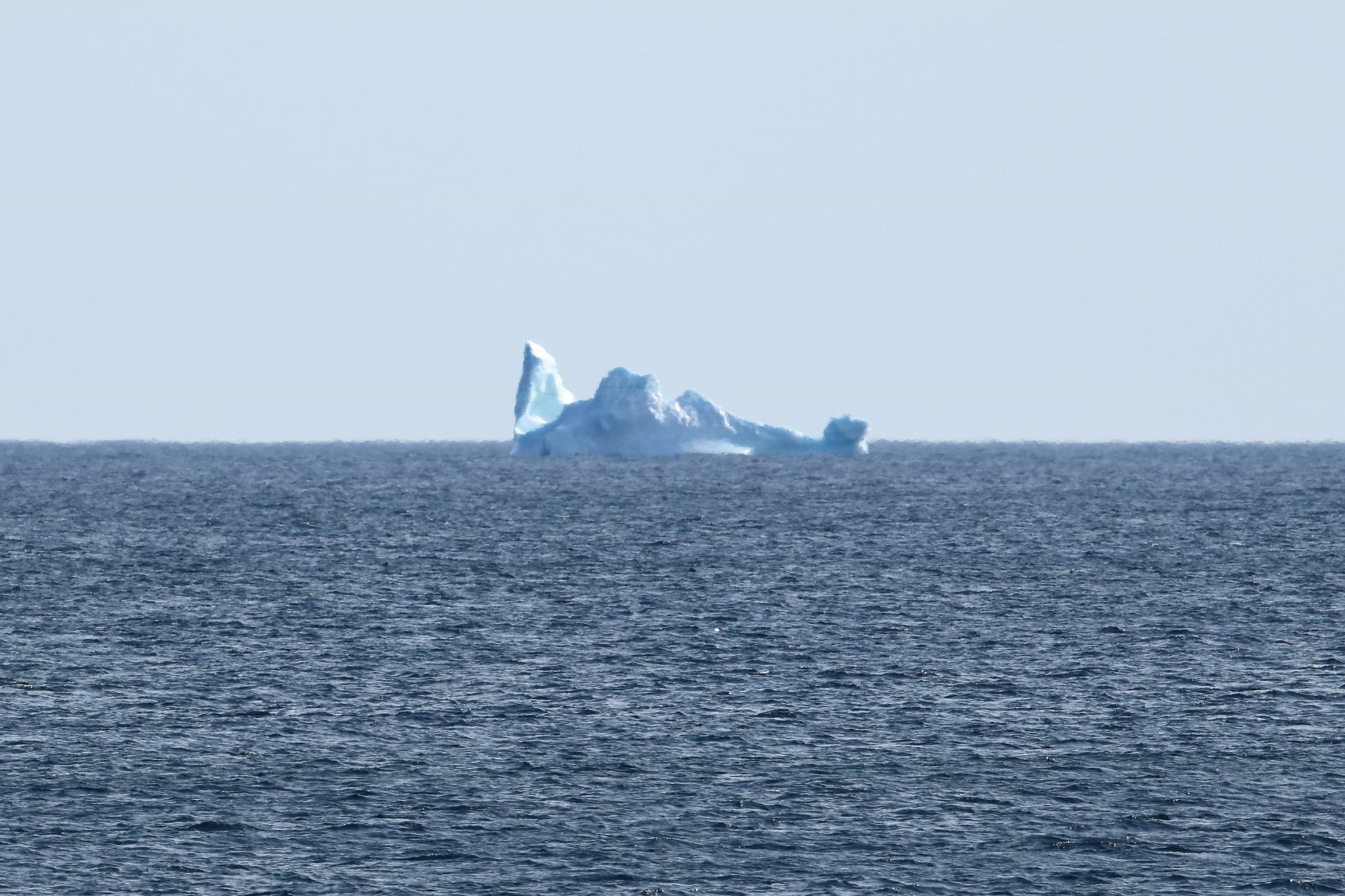
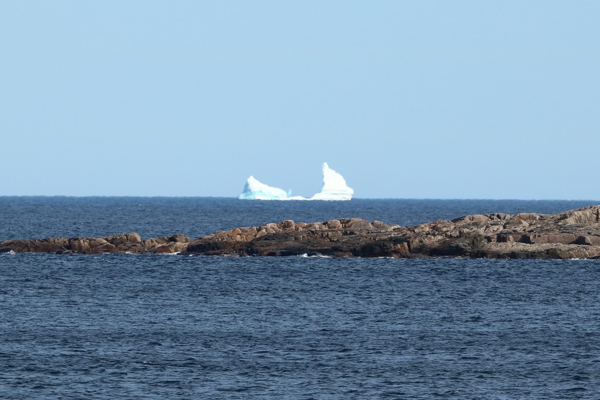
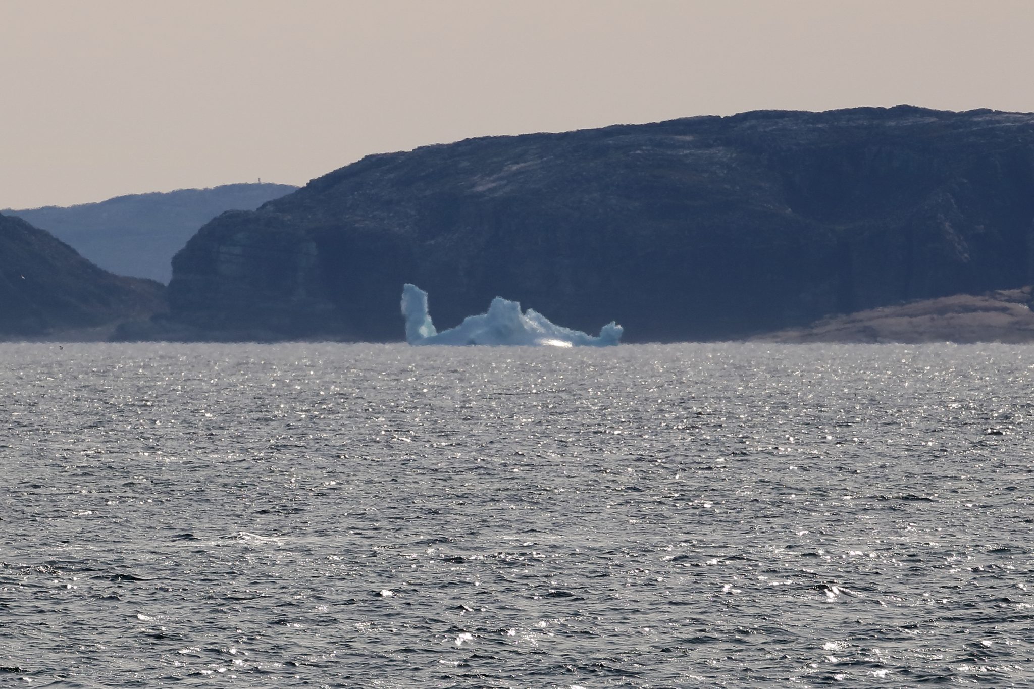
Eventually we reached Postville before noon having traveled 46 miles over 2 hours and 45 minutes – a little ahead of schedule. We decided to stay on board as that long journey down the bay was for only short visit until 1:30PM. There were a couple of enterprising people on the dock selling lunch to the northbound people on the boat. If you ever take the trip you should probably get off and eat lunch there and sample the local food as its only available on the northbound stop, as we later figured out.
Hopedale
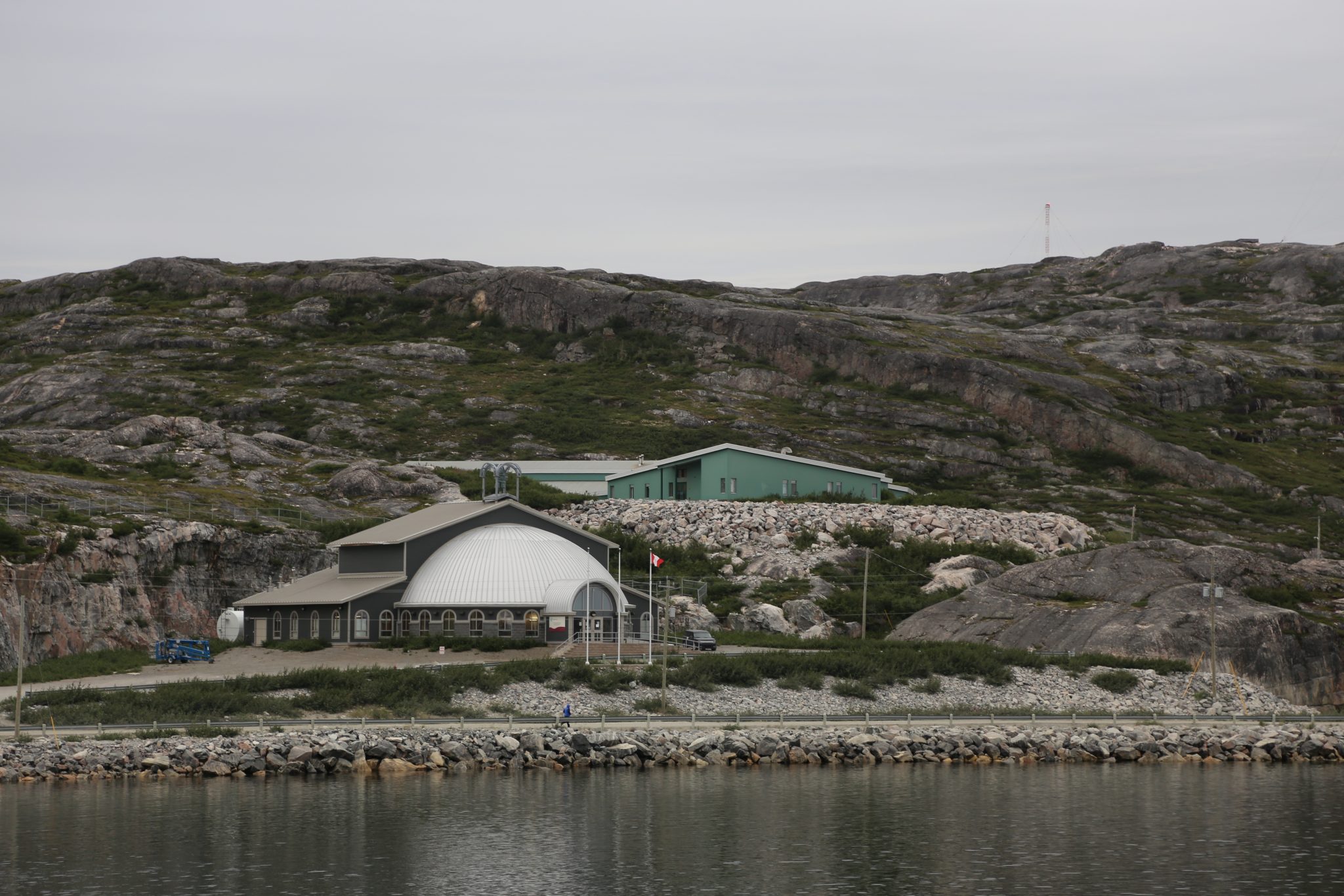
We headed back out of Kiapokok Bay and eventually back to our northwest journey up the coast and after 70 miles and 4 ½ hours we reached Hopedale (pop. 583) at 6PM. We had 2 hours so decided to go for a walk and look around. As we had approached the pier we could see a new igloo styled building. This is the Nunatsiavut Assembly building which was built as the region gained semi-autonomous government status. It is still part of Canada and Newfoundland and Labrador but has its own elected officials and handles many issues, like housing and education, closer to home. Nunatsiavut is the home of the Labrador Inuit who have been here for thousands of years. The name means “Our Beautiful Land”.
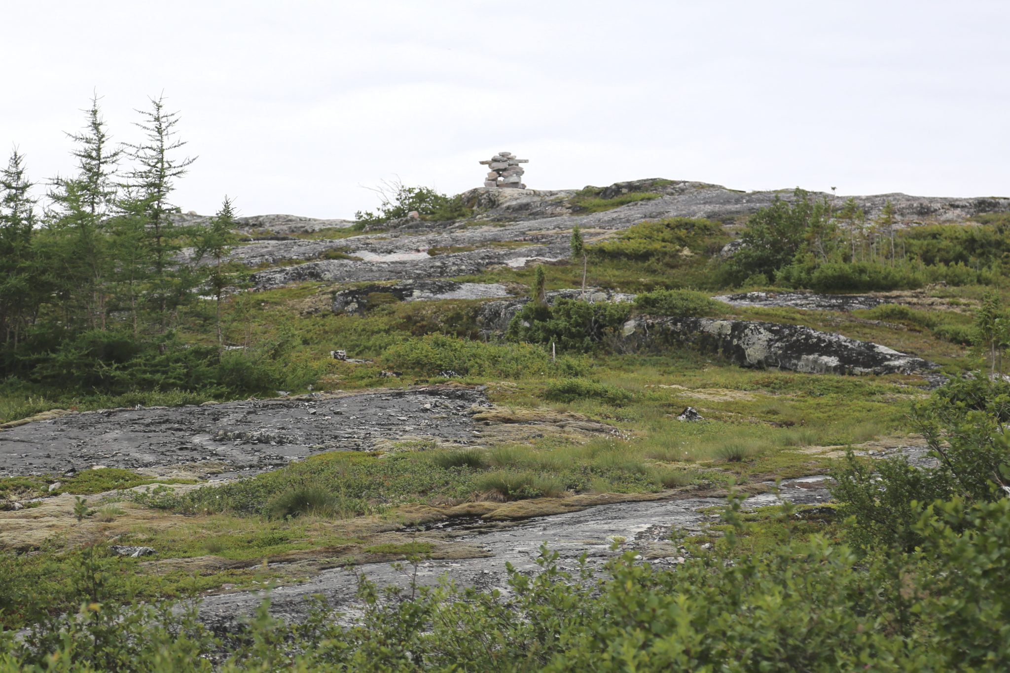
Inukshuk and Shopping
As we headed out to the dock we were stopped by a guy selling little handmade gifts. This is apparently a common thing and Debbie got a little stone carved “Inukshuk”. That’s little human figure with the outstretched arms you might see on the landscape that is typically made from piles of rocks. It is also featured on the Nunatsiavut flag in white, green, and blue representing the snow, land, and sea. Debbie got her little Inukshuk necklace and we headed up the road. We first stopped in a small store to buy some gifts and snack.
We ran into the captain of the Northern Ranger and he told us how on the first run of the season the shelves were essentially bare. During the winter, perishables or other essentials are taken from Goose Bay by air or snowmobile but it’s expensive to do that. Larger items or more durable foods are brought by ship in the summer and fall but after the long winter are long gone by the end of June. Speaking of how people get around, there are dirt or gravel roads in the towns, but they don’t really go very far. People often don’t have cars but may use 4-wheel ATVs or snowmobiles depending upon the season. In the local lingo that would be “Hondas” and “Skidoos”. The store we were in was barely marked with a name or something to indicate it’s a store. The town is very small, and everyone knows about it so there is no reason to spend money on a fancy sign for it.
Nunatsiavut Assembly
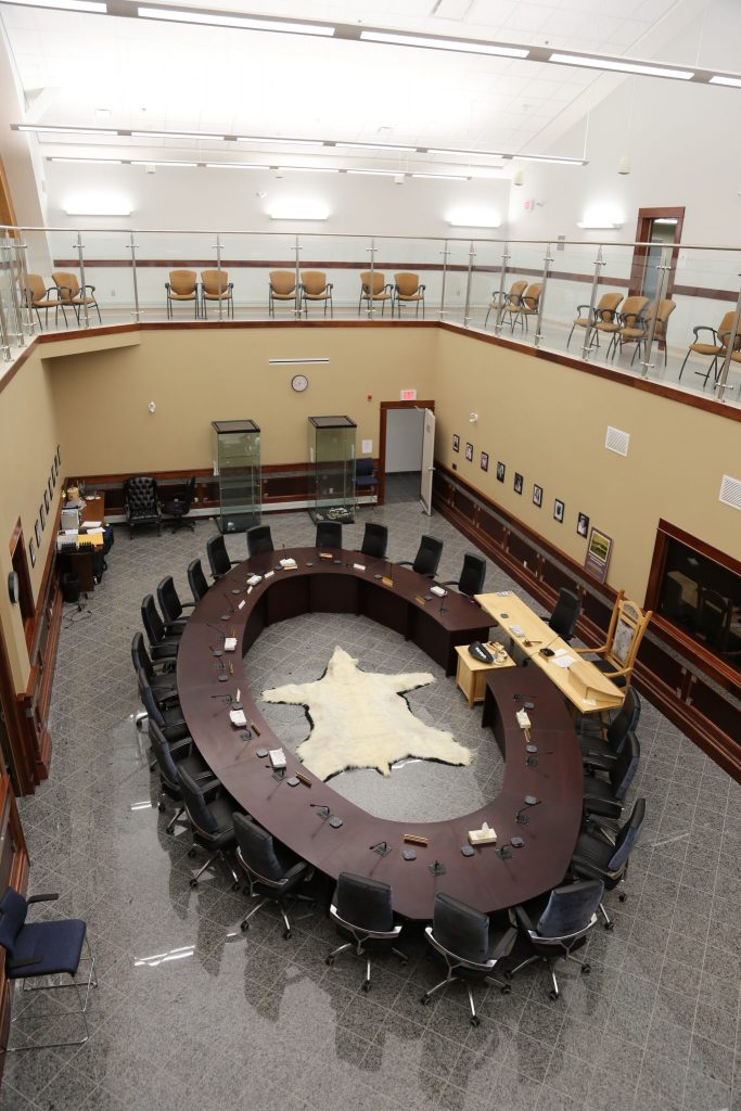
Leaving the store we walked over to up to the new assembly building. It was late in the day and it was closed so we thought we would just look from the outside. A that moment an SUV pulled up with a couple of our fellow passengers. They were being shown around town by their friend Junior Andrews who is a Pentecostal pastor in Nain, further north. He had arranged to have someone come and open the building for a quick tour. He graciously invited us to join them and inside he talked about the steps toward self-government that led to the construction of the building and more autonomy. We visited the assembly chamber which has a large oval meeting table and in its center was an impressive polar bear rug. The high back chairs had beautiful seal skin covers in keeping with the use of some traditional materials. The sealskin has a soft silky texture to it.
Polar Bear Rug in
Nunatsiavut Assembly Chamber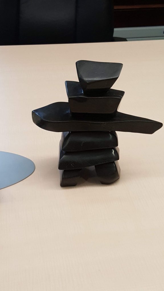
These guys are everywhere 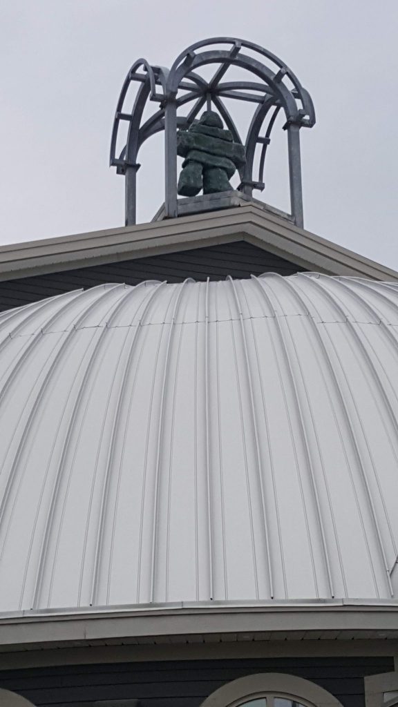
Inukshuk on the top of assembly building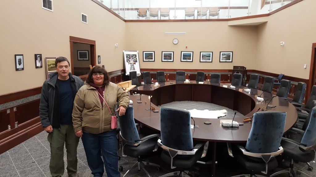
Traditional sealskin used on assembly chamber chairs
Hopedale Mission
We continued the impromptu tour and the pastor than took us over to the Hopedale Mission National Historic Site. This area of Labrador was first visited by Moravian missionaries from central Europe who established churches up and down the coast including the first permanent one in Nain in 1771. These missions helped to bring the Inuit in this area and into the Moravian church which continues to this day. The Hopedale site was built starting in the late 1700s and is still in use today. It’s a wonderful historic structure important to both history and to the residents today. Our visit was brief as the ship was leaving at 8:00PM.
Building in Hopedale painted
like the Labrador flag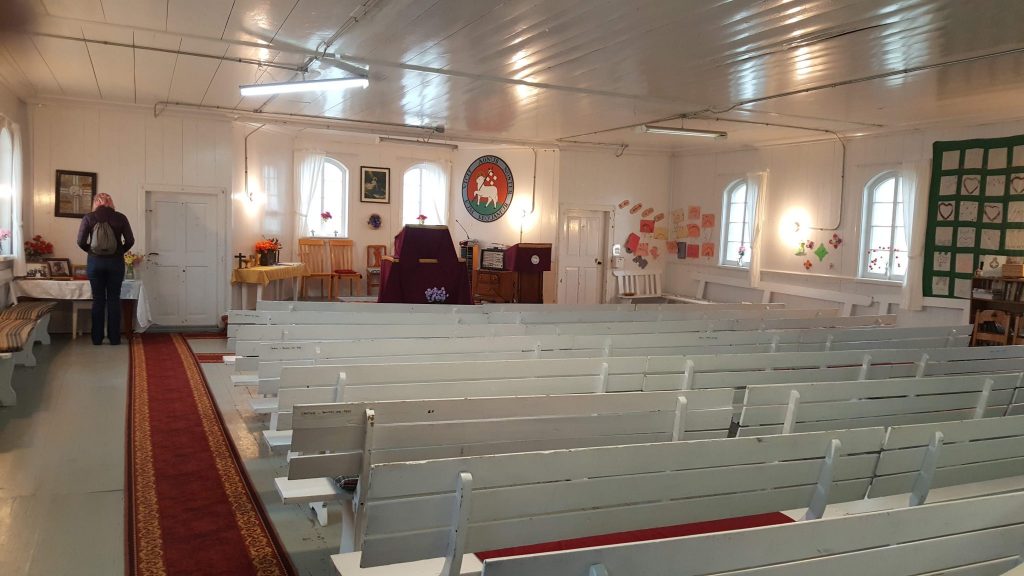
Inside Hopedale Mission 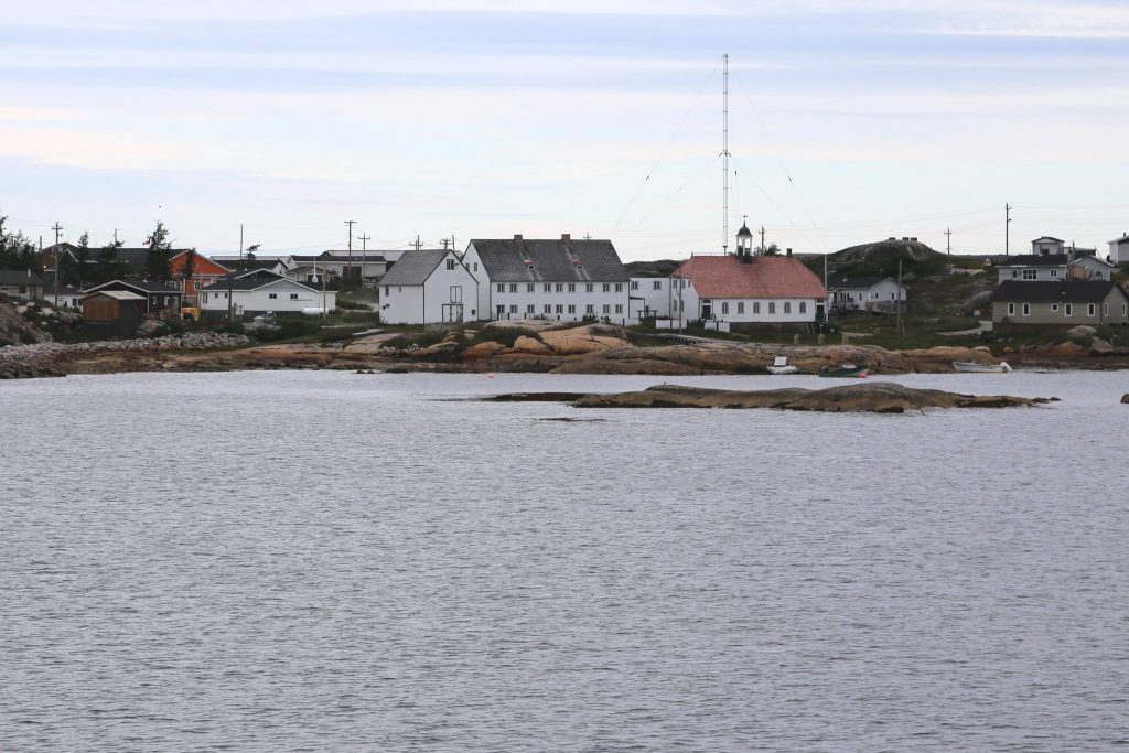
Hopedale Mission National Historic Site
Some Views around the Ship
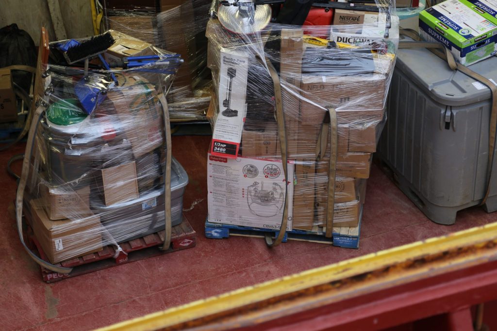
Essentials shipped on
Northern Ranger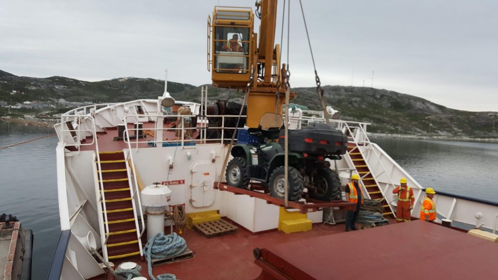
Need that Honda to get around 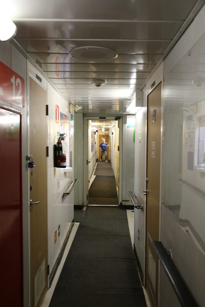
One of the stewards posing! 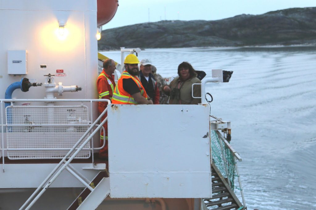
Chatting with loading crew in the fading light
Natuashish for the Night
We spent the next four hours traveling 70 miles to Natuashish (pop. 936) and arrived at midnight for an overnight stay. This town is not actually part of Nunatsiavut but is part of the Mushuasu Innu First Nation. We learned from Pastor Andrews who joined us in Hopedale that it is was a planned town that was built in 2002 to replace Davis Inlet. The region, and particularly that town, was plagued with social and substance abuse problems and the hope was that building a new town would reduce those issues. Unfortunately, it didn’t help as much as hoped and in 2008 town went dry and there was no alcohol allowed. Pastor Andrews told us people would sometimes ride the ferry north to Nain to drink and return later perhaps smuggling back alcohol or drugs. We didn’t see Natuashish as the dock is perhaps 1 km away on the other side of the peninsula where we were docked. That’s it for that day, and Nain was the next day. We traveled 349 miles on the Northern Ranger since Rigolet and a total of 884 miles on the water.
Still slowly reading my way through this trip, reading a bit, thinking about what you’ve written and what you’ve done. The ferry hops are very interesting, but must have added up quickly. How did that compare to fuel and hotel?
The minimal signage is something I noticed in the Yukon and NWT as well. The Northern Store in Tuktoyaktuk for instance.
It brings into mind an interesting point of culture, that locals know where to find things, how to get things done, who to talk to.
I am sure if I were in the USA, I’d be a bit perplexed at certain tasks. “Where do I get a fence permit from?”, for instance. “What tasks need to be taken care of in fall?”
Similarly, these residents of the north understand how to budget and allocate for a year’s worth of supplies, and they’d network with friends to fill a container before shipping, making it cheaper for everyone overall. Things like that.
When I was a kid, we lived fairly far north, and it was common to know who was heading south, and to ask them to bring things back, some of which you’d give them money for, other items would be “get me back next time you go “out”.
I’m glad you are finding my blog of interest. A reader makes it more worthwhile to write! Your point about local knowledge it certainly valid. For example a person from Florida moving to a northern climate and installing an outside faucet might not know to they should use a frost free valve and that it should be drained before winter. They would figure it out the hard way. A remote place like Tuk or Nain brings the necessity of local knowledge and preparation to a new level as correcting a mistake might be much more expensive or logistically challenging.
Regarding costs, I talk about that in later posts and you are correct the cost of the ferries added up especially when transporting the car. The Northern Ranger didn’t take cars and we didn’t need it anyhow. The cost of them was just on of the costs of taking the vacation. The Ranger with the deluxe cabin for both of us round trip was $1767 USD. The food cost was modest and we slept on it 4 nights. The expensive ferry was the Atlantic Vision overnight to Newfoundland near St. Johns which set us back $524 USD with an inside cabin but we were transporting the car. They had a nice queen bed cabin with a view but that was pricier and already booked.