Tuesday – August 7, 2018
St. Johns
We left the Gower Guest House and headed to the Bagel Cafe which is a popular breakfast destination in St. John’s.
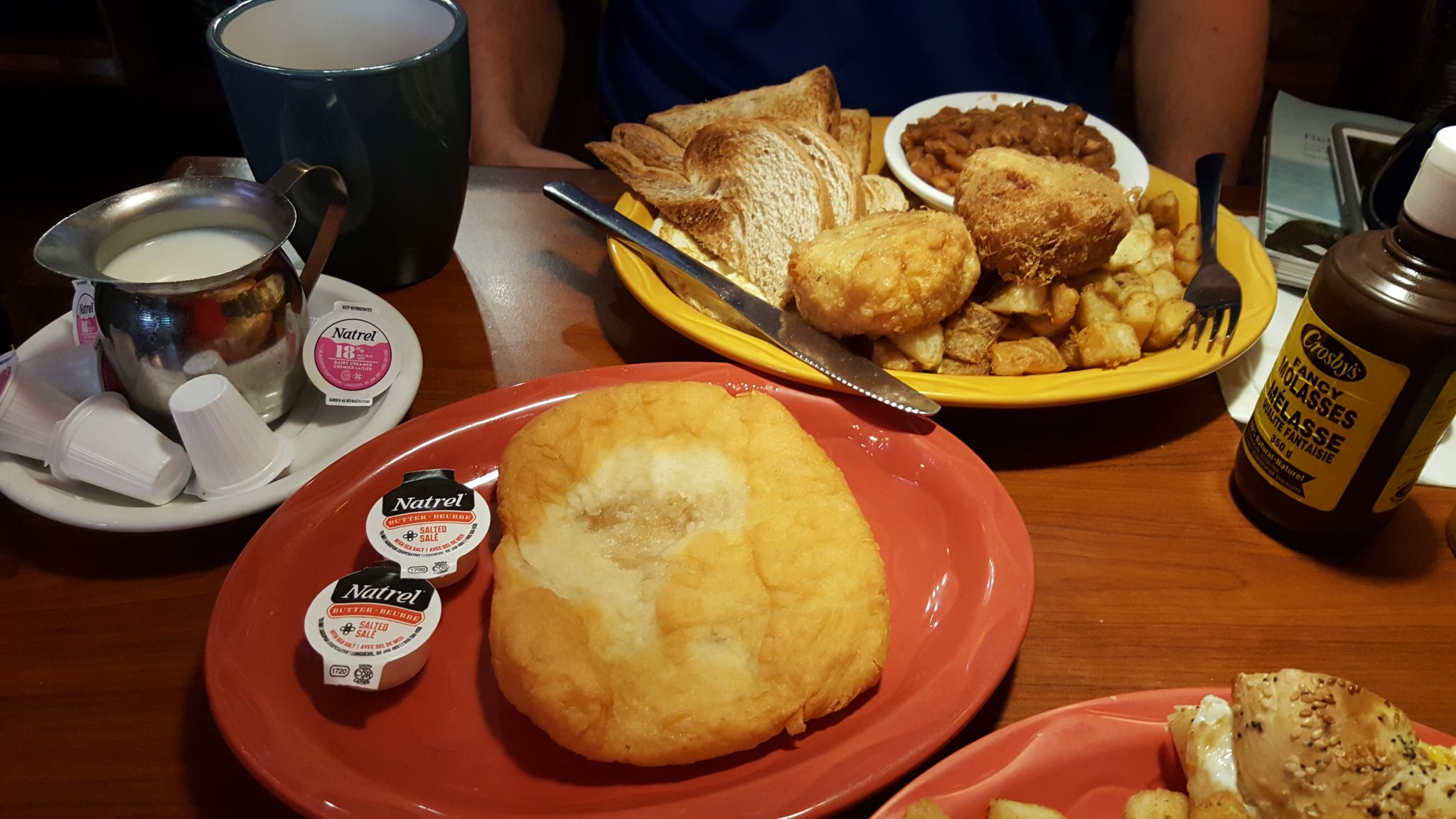
In keeping with trying to eat locally I ordered the Big Hardy Breakfast. That has various version and mine was the Cabot Tower. It has cod cakes, beans, home fries, eggs, and toast. If that wasn’t enough we got a touton to share. What the heck is a touton? It’s a fried dough with molasses on it. Needless to say I was pretty full and decided I would have to leave some of this on the plate. The fog over St. John’s was clearing so we headed back to Signal Hill for some views of the city and some history.
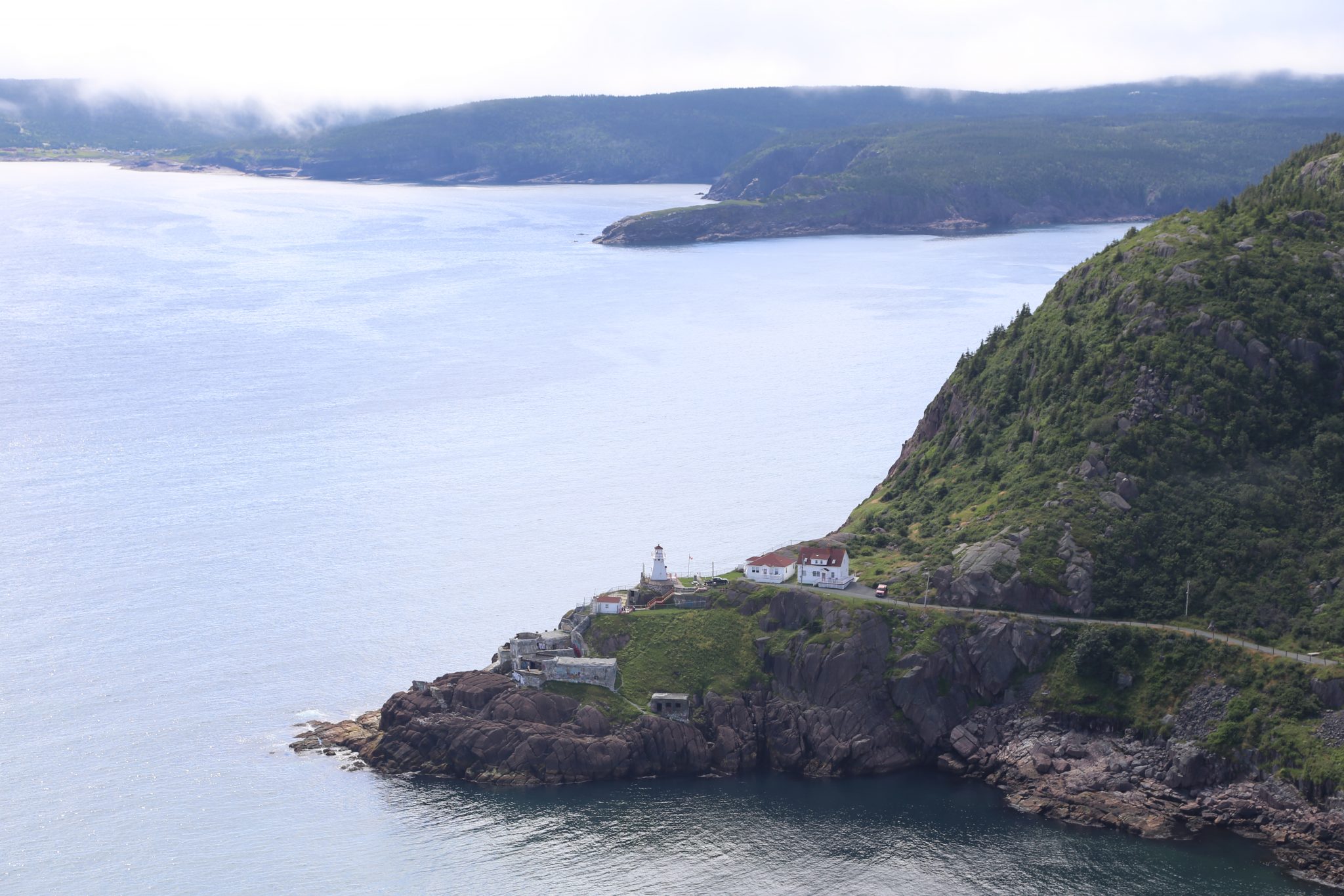
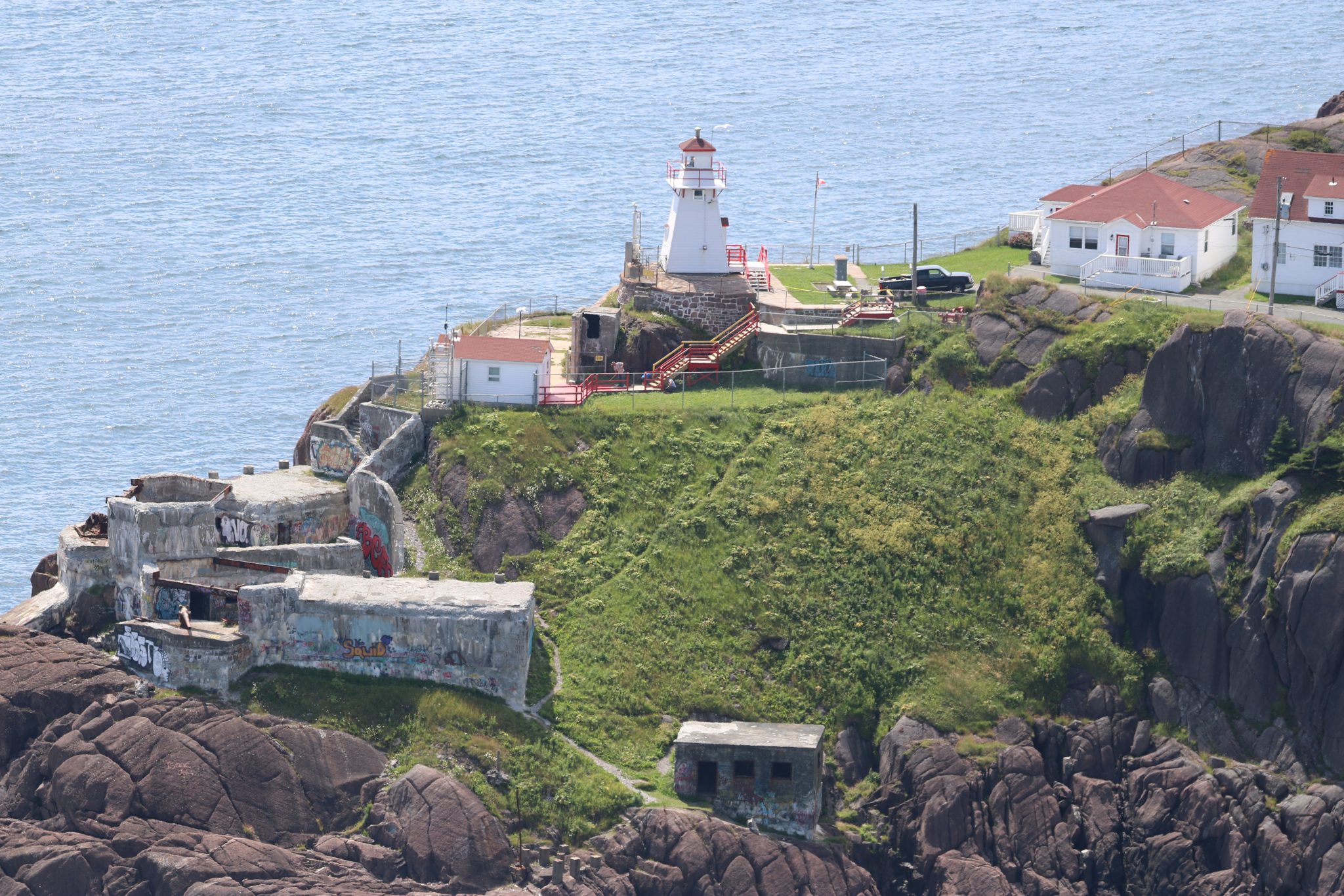
Signal Hill is over the entrance to the harbor and served in various capacities including guns that guarded it. You can see the entire harbor and city and out to sea.
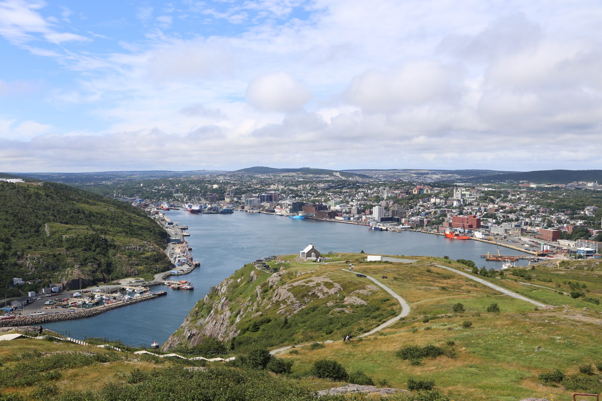
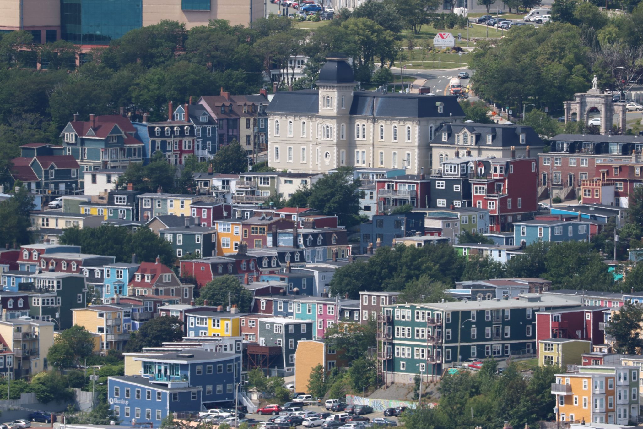
The jelly bean houses painted a colorful picture in the sunlight as they overlook the harbor.

We stuck around for noon to hear them fire the signal cannon. This was traditionally used to allow the community and ships to set their chronometers based on readings from the sextants done each day. It was quite a loud blast of the canon by some ceremonial red-coated soldiers with help from the tourists.
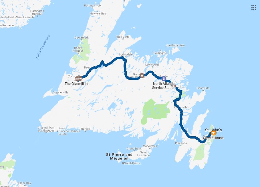
Heading across Newfoundland
We were heading up north that day and had a long drive so right afterward we headed out on the Trans-Canada Highway westbound. We passed by Gander which is where many planes landed on 9/11 and which is now the subject of the play “Come From Away”. We didn’t stop to see anything but it was nice to put a place to it. The topography of much Newfoundland features many short conifers. The soil is quite thin in many areas and of course it is up north with colder temperatures. This doesn’t lend itself to tall trees. It is gentle hills through much of the center of the island. I really expected to see some moose as we crossed but the only sign of them were the signs warning about them. In fact on this trip the only animal so far was a turkey in Massachusetts and that was it to this point. I expected more.
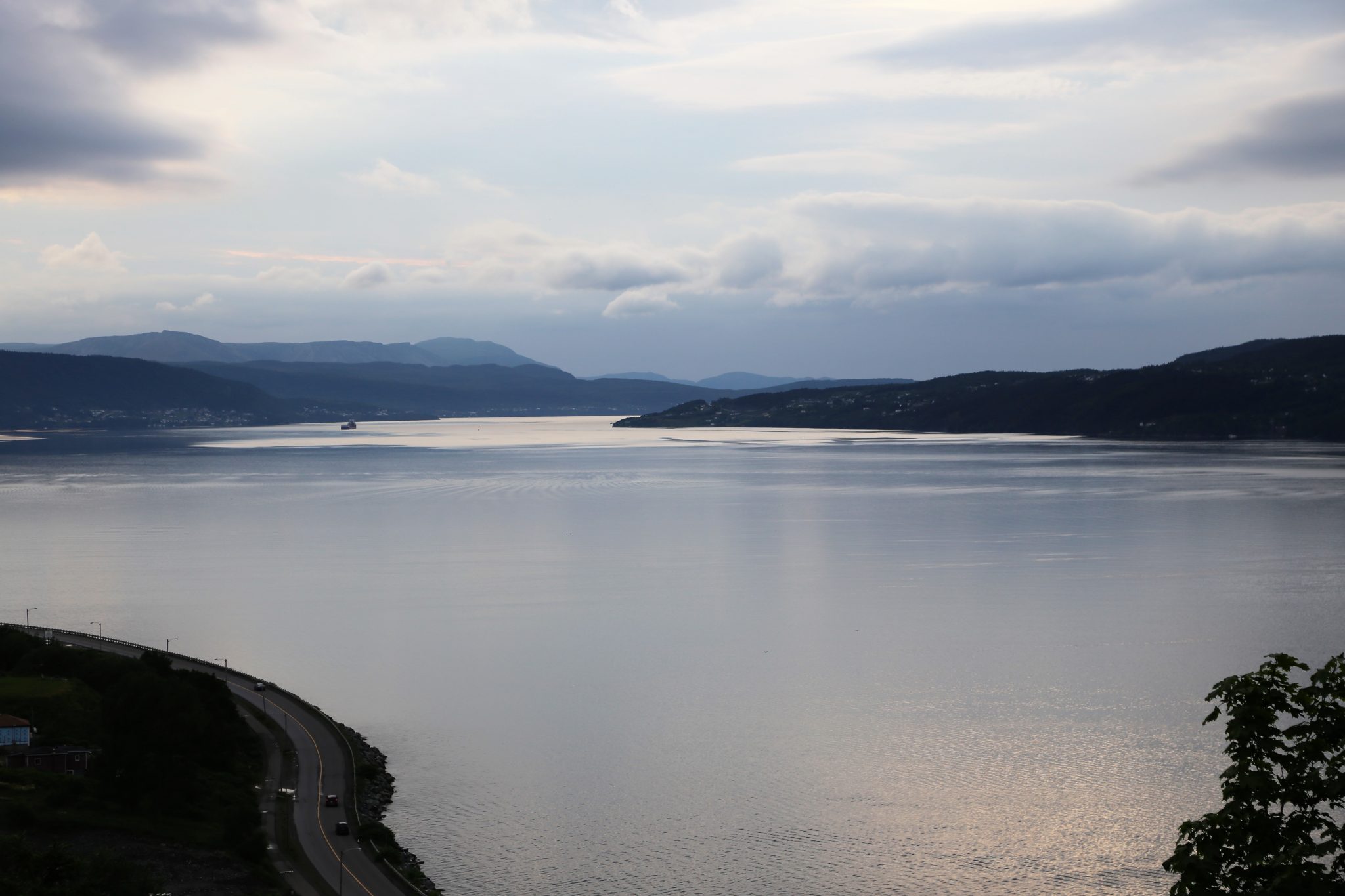
When you get up toward the northeastern part of the island near Deer Lake, things start to change. You are entering the Humber Valley and mountains are rising up. This is actually the northern end of the Appalachian Mountains. It was very scenic and beautiful. Unfortunately the rain nagging us throughout the trip was starting to threaten. We went as far as Corner Brook which sits at the end of a long arm on the Bay of Islands. Captain Cook was the one who originally mapped that area. A statue to him can be found nearby. Paper is a big industry there and this part of Newfoundland at least has the trees to harvest for that. There is a large paper mill still running right next to the water in Corner Brook.
We grabbed some dinner in that area and doubled back to the Edgewater B&B in Steady Brook. It sat right on a the Humber River and if the weather was more favorable it would have been nice to sit out on the deck next to it or to go for a swim.
Today we drove 455 miles over 8 hours and 29 minutes for a trip total of 1756 miles. The water total is still at 377 miles and 17 1/4 hours.